Gamaliel in Monroe County, Kentucky — The American South (East South Central)
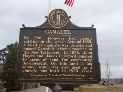
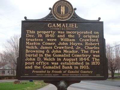
Gamaliel
This property was incorporated on Dec. 19, 1840 and the 7 original trustees were William Crawford, Maston Comer, John Hayes, Robert Welch, James Crawford Jr., Charles Browning & John Meador. The first burial in the Gamaliel Cemetery was John D. Welch in August 1844. The post office was established in 1870 and the Gamaliel bank in 1903.
Erected 2015 by Friends of Gamaliel Cemetery. (Marker Number 2436.)
Topics. This historical marker is listed in these topic lists: Cemeteries & Burial Sites • Churches & Religion • Settlements & Settlers. A significant historical month for this entry is December 1873.
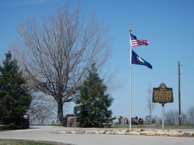
Location. 36° 38.495′ N, 85° 47.884′ W. Marker is in Gamaliel, Kentucky, in Monroe County. Marker is on West Main Street (Kentucky Route 87), on the right when traveling west. Located at the entrance to the Gamaliel Cemetery. Dedicated on Friday, March 27, 2015 at the Gamaliel Elementary School - Gamaliel History Day. Touch for map. Marker is in this post office area: Gamaliel KY 42140, United States of America. Touch for directions.
Other nearby markers. At least 8 other markers are within 6 miles of this marker, measured as the crow flies. Gamaliel Cemetery (within shouting distance of this marker); Free-Town Church (approx. 2.3 miles away); Hermitage Springs (approx. 4.4 miles away in Tennessee); James Chism (approx. 4.6 miles away); Camp Anderson (approx. 5˝ miles away); Truth Will Prevail (approx. 5.6 miles away); The Meetinghouse (approx. 5.6 miles away); Back in the Woods (approx. 5.6 miles away). Touch for a list and map of all markers in Gamaliel.
Additional keywords. Tompkinsville, Monroe County, Kentucky, Friends of Gamaliel Cemetery
Credits. This page was last revised on June 16, 2016. It was originally submitted on March 11, 2015, by Chad Comer of Gamaliel, Kentucky. This page has been viewed 584 times since then and 39 times this year. Photos: 1, 2. submitted on March 26, 2015, by Chad Comer of Gamaliel, Kentucky. 3. submitted on March 29, 2015, by Chad Comer of Gamaliel, Kentucky. • Al Wolf was the editor who published this page.


