Tullahoma in Coffee County, Tennessee — The American South (East South Central)
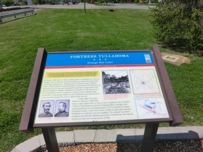
Fortress Tullahoma
Strategic Rail Center
— Tullahoma Campaign —
After the Battle of Stones River ended on January 2, 1863, Union Gen. William S. Rosecrans occupied Murfreesboro. Confederate Gen. Braxton Bragg withdrew south to the Highland Rim to protect the rail junction at Tullahoma, Bragg’s headquarters, and the roads to Chattanooga. Bragg fortified Shelbyville and Wartrace behind lightly defended mountain gaps. After months of delay, Rosecrans feinted toward Shelbyville on June 23 and then captured Hoovers and Liberty Gaps the next day. A mounted infantry brigade captured Manchester on June 27. The Confederates concentrated at Tullahoma. Rosecrans planned to attack on July 1, but Bragg retreated. By July 7, the Confederates were in Chattanooga.
(main text)
In January 1863, after the Battle of Stones River, Confederate Gen. Braxton Bragg’s Army of Tennessee fortified Tullahoma to protect the supply depot and Bragg’s headquarters. Tullahoma also served as the army’s medical center, with divisional and general hospitals. The Nashville and Chattanooga Railroad was one of the most strategically important transportation corridors in the Western Theater. Tullahoma, the mid-point of the line, served both Confederate and Union armies as a logistics center. Federal troops arrived here in the spring of 1862, but the Confederates took back the town in the fall and supplied their army at Murfreesboro by rail.
In June 1863, Union Gen. William S. Rosecrans made Tullahoma a major objective for his Army of the Cumberland. After the Battle of Hoovers Gap, Rosecrans gained the Highland Rim on Bragg’s right and threatened his line of communications. The Confederates evacuated Tullahoma on July 1, and it then became a Federal supply depot and post. Tullahoma survived both war and occupation. The railroad was reincorporated as the Nashville, Chattanooga and St. Louis Railway. The railroad remains an important transportation corridor.
(captions)
(lower left) Gen. Braxton Bragg; Gen. William S. Rosecrans - Courtesy Library of Congress
(upper center) “Breastworks and Chevaux-de-Frise at Tullahoma, Tennessee, July 1st, 1863,” from David B. Floyd, History of the Seventy-fifth Regiment of Indiana Infantry Volunteers (1893)
(upper right) “Sketch of Tullahoma, Tenn. and Vicinity.” July 6, 1863, from Military Atlas of the War of the Rebellion (1891-1895)
Erected by Tennessee Civil War Trails.
Topics and series. This historical marker is listed in these topic lists: Railroads & Streetcars • War, US Civil. In addition, it is included in the Tennessee Civil War Trails series list. A significant historical month for this entry is January 1944.
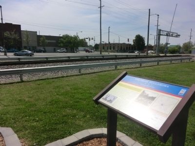
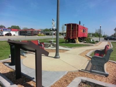
Location. 35° 21.798′ N, 86° 12.601′ W. Marker is in Tullahoma, Tennessee, in Coffee County. Marker is at the intersection of NE Atlantic Street and East Grundy Street, on the right when traveling south on NE Atlantic Street. The marker is located in Caboose Park. Touch for map. Marker is in this post office area: Tullahoma TN 37388, United States of America. Touch for directions.
Other nearby markers. At least 8 other markers are within walking distance of this marker. Tullahoma Veterans Memorial (a few steps from this marker); The Red Caboose (a few steps from this marker); A Railroad Town (a few steps from this marker); Verandah Hotel — RR Depot and Dr. Cowan House (within shouting distance of this marker); L.D. Hickerson House (approx. 0.2 miles away); Provost Marshall's Headquarters South Jackson Street (approx. 0.2 miles away); Livery Stable (approx. 0.2 miles away); Wilson-Crouch (approx. ¼ mile away). Touch for a list and map of all markers in Tullahoma.
Credits. This page was last revised on June 16, 2016. It was originally submitted on July 13, 2014, by Don Morfe of Baltimore, Maryland. This page has been viewed 1,065 times since then and 65 times this year. Last updated on March 12, 2015, by J. Makali Bruton of Accra, Ghana. Photos: 1, 2, 3. submitted on July 13, 2014, by Don Morfe of Baltimore, Maryland. • Bill Pfingsten was the editor who published this page.


