Smithville in Dekalb County, Tennessee — The American South (East South Central)
DeKalb County in the Civil War
A Country and a County Divided
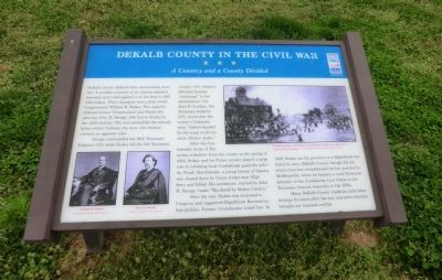
Savage commanded the 16th Tennessee Infantry (CS) while Stokes led the 5th Tennessee Cavalry (US). Stokes’s followers became “scalawags” to the secessionists. Col. John F. Goodner, 7th Tennessee Infantry (CS), wrote that the county’s Unionists were “thieves headed by the scum of all creation, Stokes’ arabs.”
After the Confederate Army of Tennessee withdrew from the county in the spring of 1863, Stokes and his Union cavalry played a large role in subduing local Confederate guerrilla activity. Frank Marchbanks, a young lawyer of Sparta, was chased down by Union troops near Sligo ferry and killed. His tombstone, erected by John H. Savage, reads “Murdered by Stokes Cavalry.”
After the war, Stokes was reelected to Congress and supported Republican Reconstruction policies. Former Confederates hated him. In 1869, Stokes ran for governor as a Republican but failed to carry DeKalb County. Savage did not return here but reestablished his law practice in McMinnville, where he became a vocal Democrat defender of the Confederate Lost Cause in the Tennessee General Assembly in the 1870s.
Many DeKalb County residents held bitter feeling for years after the war, and every election brought out renewed conflict.
(captions)
(lower left) William B. Stokes Courtesy Library of Congress John H. Savage Courtesy Library of Congress
(upper right) DeKalb County Courthouse (demolished in 1890) and square during a public hanging - Courtesy DeKalb County Historical Society
Erected by Tennessee Civil War Trails.
Topics and series. This historical marker is listed in this topic list: War, US Civil. In addition, it is included in the Tennessee Civil War Trails series list. A significant historical month for this entry is June 1862.
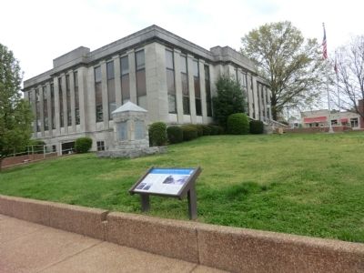
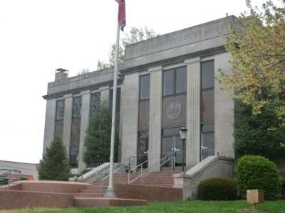
Location. 35° 57.636′ N, 85° 48.781′ W. Marker is in Smithville, Tennessee, in Dekalb County. Marker is on South Public Square near East Public Square, on the left when traveling east. The marker is located on the grounds of the DeKalb County Courthouse. Touch for map. Marker is in this post office area: Smithville TN 37166, United States of America. Touch for directions.
Other nearby markers. At least 8 other markers are within 9 miles of this marker, measured as the crow flies. Darrin Vincent (here, next to this marker); Veterans Memorial DeKalb County Tennessee (a few steps from this marker); DeKalb County Confederate Monument (a few steps from this marker); Dekalb County (within shouting distance of this marker); Evins' Old Mill (approx. 1.4 miles away); Beckwith Inn (approx. 2.7 miles away); Battle of Snow Hill (approx. 7.1 miles away); Confederate Guerrilla (approx. 8.9 miles away). Touch for a list and map of all markers in Smithville.
Credits. This page was last revised on June 16, 2016. It was originally submitted on June 10, 2014, by Don Morfe of Baltimore, Maryland. This page has been viewed 1,634 times since then and 633 times this year. Last updated on March 14, 2015, by J. Makali Bruton of Accra, Ghana. Photos: 1, 2, 3. submitted on June 10, 2014, by Don Morfe of Baltimore, Maryland. • Bill Pfingsten was the editor who published this page.


