Chattanooga in Hamilton County, Tennessee — The American South (East South Central)
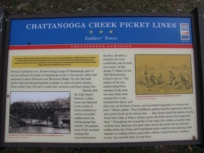
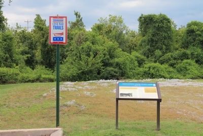
Chattanooga Creek Picket Lines
Soldier's Truces
— Chattanooga Campaign —
After the Battle of Chickamauga in September 1863, Union Gen. William S. Rosecrans retreated to Federal-occupied Chattanooga, a strategically vital rail center, where Confederate Gen. Braxton Bragg laid siege from Lookout Mountain and Missionary Ridge. Union Gen. Ulysses S. Grant took command in October and began his efforts to break the siege. Bragg detached forces under Gen. James Longstreet to attack Knoxville as a diversion. After Gen. William T. Sherman reinforced Grant in November, the Federals attacked the heights and Bragg retreated. The Union army held the city for the rest of the war.
(Main Text):
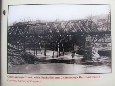
During Confederate Gen. Braxton Bragg's siege of Chattanooga, part of his line followed the bends of Chattanooga Creek in the narrow valley that separated Lookout Mountain and Missionary Ridge. On this line both armies deployed advanced guards or pickets to warn of enemy attacks. These soldiers dug rifle pits to make their positions safe from enemy fire.
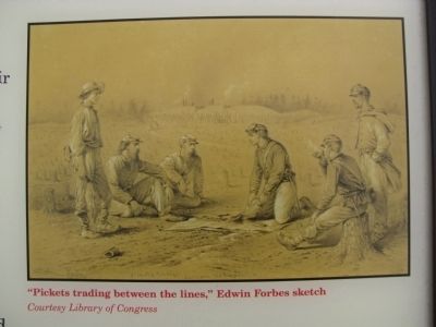
Shortly after the siege began, however, a short truce was declared to let a train of Union ambulances retrieve wounded soldiers from the Chickamauga battlefield. The pickets, tired of the constant sniping that occurred between the lines, decided to continue the truce unofficially and on their own terms. As Sgt. Joseph T. Gibson of the 78th Pennsylvania Infantry put it, "The pickets of the two armies along Chattanooga Creek were not more than from seventy-five to one hundred feet apart, and they were on the best of terms, and conversed frequently on various subject." Gibson added: "The Confederate pickets had the impression that we were pretty hard up for rations, but, ...they always found the pickets on the Union line ready to fling a cracker across the little stream that separated them." Throughout the remainder of the siege, the soldiers on picket duty could be seen chatting with each other across the creek and on occasion soldiers from the Union and Confederate army could be seen playing cards together or trading tobacco and coffee. Officers deplored these "soldiers' truces" but could do little to stop them.
Erected by Tennessee Civil War Trails.
Topics and series. This historical marker is listed in this topic list: War, US Civil. In addition, it is included in the Tennessee Civil War Trails series list. A significant historical month for this entry is September 1863.
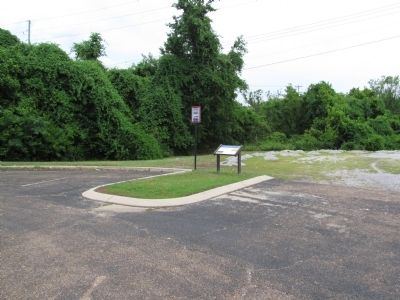
Location. 35° 1.366′ N, 85° 19.193′ W. Marker is in Chattanooga, Tennessee, in Hamilton County. Marker is on St. Elmo Avenue, in the median. Marker is located in a small parking lot at the north end of St. Elmo Avenue near Broad Street and the Southern Saddlery Company building. Follow the TN Civil War Trails signs from Broad Street. Touch for map. Marker is at or near this postal address: 3085 Broad Street, Chattanooga TN 37408, United States of America. Touch for directions.
Other nearby markers. At least 8 other markers are within one mile of this marker, measured as the crow flies. Daniel Ross (approx. half a mile away); Chattanooga Howard School (approx. 0.6 miles away); The Will Cummings Highway (approx. ¾ mile away); Cross Roads (approx. ¾ mile away); Camp Ross (approx. one mile away); Chattanooga Plow Power House (approx. one mile away); St. Elmo World War I Memorial (approx. 1.1 miles away); Lookout Mountain (approx. 1.1 miles away). Touch for a list and map of all markers in Chattanooga.
Credits. This page was last revised on June 16, 2016. It was originally submitted on June 28, 2011, by Lee Hattabaugh of Capshaw, Alabama. This page has been viewed 1,170 times since then and 38 times this year. Last updated on March 18, 2015, by J. Makali Bruton of Accra, Ghana. Photos: 1, 2, 3, 4. submitted on June 28, 2011, by Lee Hattabaugh of Capshaw, Alabama. 5, 6. submitted on September 3, 2012, by Dale K. Benington of Toledo, Ohio. • Bill Pfingsten was the editor who published this page.
