Mountain Creek in Chattanooga in Hamilton County, Tennessee — The American South (East South Central)
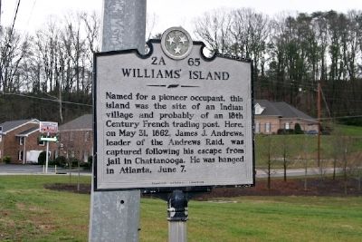
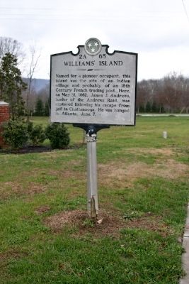
Williams' Island
Erected by Tennessee Historical Commission. (Marker Number 2A 65.)
Topics and series. This historical marker is listed in these topic lists: Native Americans • Notable Places • Settlements & Settlers • War, US Civil. In addition, it is included in the Tennessee Historical Commission series list. A significant historical date for this entry is May 31, 1862.
Location. Marker is missing. It was located near 35° 5.135′ N, 85° 19.595′ W. Marker was in Chattanooga, Tennessee, in Hamilton County. It was in Mountain Creek. Marker was on Signal Mountain Road (U.S. 127), on the right when traveling south. Touch for map. Marker was in this post office area: Chattanooga TN 37405, United States of America. Touch for directions.
Other nearby markers. At least 8 other markers are within 2 miles of this location, measured as the crow flies. Union Army Hospital (approx. 0.4 miles away); Wilder's Artillery Position (approx. one mile away); Reinforcing Chattanooga (approx. 1.4 miles away); Chattanooga High School (approx. 1˝ miles away); Sherman's Hideout (approx. 1˝ miles away); Hill Overlooks & Industrial Past (approx. 1.8 miles away); Brown's Ferry Federal Road (approx. 1.9 miles away); A "Trace" of the Past (approx. 1.9 miles away). Touch for a list and map of all markers in Chattanooga.
More about this marker. Marker appears, according to Google Street View, to have gone missing sometime between 2011 and 2014. Reported by David Whipple of Knoxville, TN.
Credits. This page was last revised on February 7, 2023. It was originally submitted on November 27, 2008, by R. E. Smith of Nashville, Tennessee. This page has been viewed 1,873 times since then and 42 times this year. Last updated on March 18, 2015, by J. Makali Bruton of Accra, Ghana. Photos: 1, 2. submitted on November 27, 2008, by R. E. Smith of Nashville, Tennessee. • Bill Pfingsten was the editor who published this page.

