Near Hartford in Lyon County, Kansas — The American Midwest (Upper Plains)
Managing Moist Soil Areas
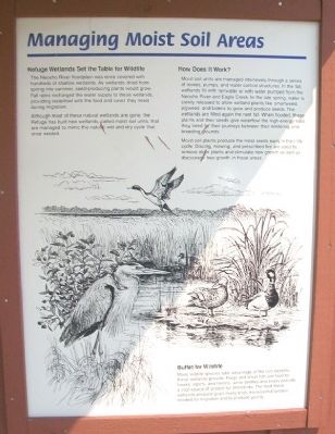
Refuge Wetlands Set the Table for Wildlife
The Neosho River floodplain was once covered with hundreds of shallow wetlands. As wetlands dried from spring into summer, seed-producing plants would grow. Fall rains recharged the water supply to these wetlands, providing waterfowl with the food and cover they need during migration.
Although most of these natural wetlands are gone, the Refuge has built new wetlands, called moist soil units, that are managed to mimic the natural wet and dry cycle that once existed.
How Does It Work?
Moist soil units are managed intensively through a series of levees, pumps, and water control structures. In the fall, wetlands fill with rainwater or with water pumped from the Neosho River and Eagle Creek. In the late spring, water is slowly released to allow wetland plants like smartweed, pigweed, and bidens to grow and produce seeds. The wetlands are filled again the next fall. When flooded, these plants and their seeds give waterfowl the high-energy food they need for their journeys between their wintering and breeding grounds.
Moist soil plants produce the most seeds early in their life cycle. Discing, mowing, and prescribed fire are used to remove older plants and stimulate new growth as well as discourage tree growth in these areas.
Buffet for Wildlife
Many wildlife species take advantage of the rich benefits these wetlands provide. Frogs and small fish are food for hawks, egrets, and herons, while beetles and snails provide a vital source of protein for shorebirds. The food these wetlands produce gives many birds the essential protein needed for migration and to produce young.
Erected by U.S. Fish and Wildlife Service.
Topics. This historical marker is listed in these topic lists: Animals • Environment.
Location. 38° 20.577′ N, 95° 57.055′ W. Marker is near Hartford, Kansas, in Lyon County. Marker is on State Highway 130 south of 22nd Road, on the right when traveling south. Marker is at the Refuge information kiosk, about three miles north of Hartford. Touch for map. Marker is in this post office area: Hartford KS 66854, United States of America. Touch for directions.
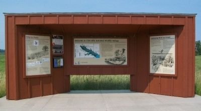
Other nearby markers. At least 7 other markers are within 8 miles of this marker, measured as the crow flies. Welcome to Flint Hills National Wildlife Refuge (here, next to this marker); Tallgrass Prairie (here, next to this marker); All Veterans Tribute (approx. 2.2 miles away); Hartford Collegiate Institute (approx. 2˝ miles away); Civil War Memorial (approx. 6.6 miles away); World War II Memorial (approx. 7.1 miles away); City of Lebo (approx. 7.1 miles away).
Also see . . . Flint Hills National Wildlife Refuge Wildlife and Habitat. U.S. Fish & Wildlife Service website entry (Submitted on March 18, 2015, by William Fischer, Jr. of Scranton, Pennsylvania.)
Credits. This page was last revised on May 13, 2023. It was originally submitted on March 18, 2015, by William Fischer, Jr. of Scranton, Pennsylvania. This page has been viewed 274 times since then and 8 times this year. Photos: 1, 2, 3. submitted on March 18, 2015, by William Fischer, Jr. of Scranton, Pennsylvania.


