Norden in Nevada County, California — The American West (Pacific Coastal)
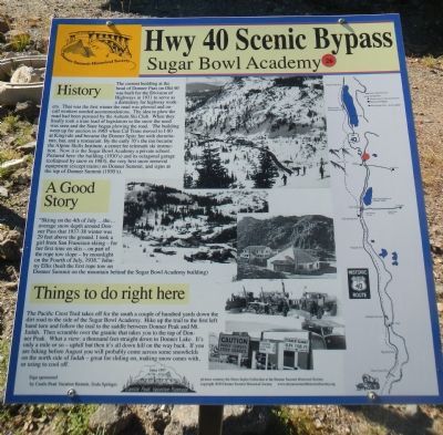
Sugar Bowl Academy
Hwy 40 Scenic Bypass
History
The current building at the head of Donner Pass on Old 40 was built for the Division of Highways in 1931 to serve as a dormitory for highway workers. That was the first winter the road was plowed and on-call workers needed accommodations. The idea to plow the road had been pursued by the Auburn Ski Club. When they finally took a train load of legislators to the snow the need was seen and the State began plowing the road. The building went up for auction in 1965 when Cal Trans moved to I-80 at Kingvale and became the Donner Spitz Inn with dormitory, bar, and a restaurant. By the early 70’s the inn became the Alpine Skills Institute, a center for telemark ski instruction. Now it is the Sugar Bowl Academy a private school. Pictured here: the building (1930’s) and its octagonal garage (collapsed by snow in 1983), the very first snow removal equipment (except trains) on Donner Summit, and signs at the top of Donner Summit (1930’s).
A Good Story
“Skiing on the 4th of July… the… average snow depth around Donner Pass that 1937-38 winter was 29 feet above the ground. I took a girl from San Francisco skiing - for her first time on skis - on part of the rope tow slope - by moonlight on the Fourth of July, 1938.” Johnny Ellis (built first rope tow on Donner Summit on the mountain behind the Sugar Bowl Academy building)
Things to do right here
The Pacific Crest Trail takes off for the south a couple of hundred yards down the dirt road to the side of Sugar Bowl Academy. Hike up the trail to the first left hand turn and follow the trail to the saddle between Donner Peak and Mt. Judah. Then scramble over the granite that takes you to the top of Donner Lake. It’s only a mile or so - uphill but then its all down hill on the way back. If you are hiking before August you will probably come across some snowfields on the north side of Judah - great for sliding on, making snow cones with, or using to cool off.
Erected by Donner Summit Historical Society. (Marker Number 26.)
Topics and series. This historical marker is listed in these topic lists: Entertainment • Sports. In addition, it is included in the Donner Summit Historical Society, and the Nevada - 20-Mile Museum - Hwy 40 Scenic Bypass series lists. A significant historical month for this entry is July 1938.
Location. 39° 19.001′ N, 120° 19.574′ W. Marker is in Norden, California, in Nevada County. Marker is at the intersection of Donner Pass Road and Old Donner Summit Road, on the right when traveling east on Donner Pass Road. Touch for map. Marker is at or near this postal address: 19189 Donner Pass Road, Norden CA 95724, United States of America. Touch for directions.
Other nearby markers. At least 8 other markers are within walking distance of this marker. Great Summit Tunnel of the Sierra Nevada (within shouting distance of this marker); Donner Pass Airway Station & Beacon (within shouting distance of this marker); Donner Ski Ranch (approx. 0.2 miles away); Summit Hotel (approx. 0.2 miles away); Tunnel 6 (approx. 0.2 miles away); Sacred Symbols From Ancient Times (approx. 0.3 miles away); Petroglyphs (approx. 0.3 miles away); China Wall (approx. 0.3 miles away). Touch for a list and map of all markers in Norden.
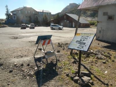
Regarding Sugar Bowl Academy. This marker is removed every Fall for the winter months and replaced every Spring for the summer season.
Also see . . . The 20-Mile Museum Brochure. Information and the listing of all the markers within this series. (Submitted on March 28, 2015.)
Credits. This page was last revised on June 16, 2016. It was originally submitted on March 24, 2015, by Barry Swackhamer of Brentwood, California. This page has been viewed 363 times since then and 10 times this year. Photos: 1, 2. submitted on March 24, 2015, by Barry Swackhamer of Brentwood, California. • Syd Whittle was the editor who published this page.

