Yosemite National Park in Mariposa County, California — The American West (Pacific Coastal)
A Seasonal Lake
Inscription.
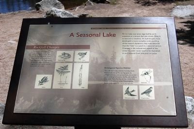
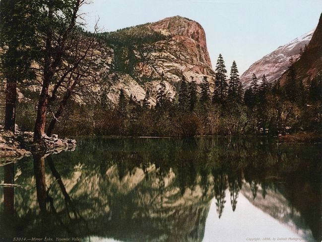
Mirror Lake was once regarded by park scientists as a stream-fed lake slowly filling in to become a meadow. As hydrologists have developed a more complex understanding of the water's dynamics, they now theorize that the "lake" is a pool in a seasonal stream. Changes in the volume and speed of the stream's water cause sand to be deposited in and scoured from the pool in cycles.
Rockfall Changes
The rockfall that created Mirror Lake altered the streamside habitat of Tenaya Creek. More aquatic and streamside plants took hold in the pooled water and saturated soils. These plants, in turn, are habitat for ducks, frogs, and other aquatic species that prefer still water.
Endangered Species Habitat
The cliffs and rocky crevices looming above Mirror Lake are prime nesting spots for peregrine falcons and spotted bats, two of the park's endangered species. Swifts and swallows also roost there, feeding on insects that thrive in the pooled water. Peregrine falcons prey upon the insect-eating birds.
Erected by Yosemite Fund.
Topics. This historical marker is listed in these topic lists: Animals • Environment • Waterways & Vessels.
Location. 37° 44.894′ N, 119° 32.981′ W. Marker is in Yosemite National Park, California, in Mariposa County. The marker is located along the Mirror Lake Trail. Touch for map. Marker is in this post office area: Yosemite National Park CA 95389, United States of America. Touch for directions.
Other nearby markers. At least 8 other markers are within 2 miles of this marker, measured as the crow flies. Bracken Fern and Baskets (within shouting distance of this marker); Visitors at Mirror Lake (about 300 feet away, measured in a direct line); Selling the Sublime (about 300 feet away); Mirror Lake Resources (about 500 feet away); Natural Dam (about 600 feet away); Happy Isles Gaging Station (approx. 1.3 miles away); The Ahwahnee Porte Cochere (approx. 1.3 miles away); The Grand Lodge (approx. 1.4 miles away). Touch for a list and map of all markers in Yosemite National Park.
Credits. This page was last revised on June 16, 2016. It was originally submitted on March 26, 2015, by Eric Polk of Lakewood, California. This page has been viewed 390 times since then and 8 times this year. Photos: 1. submitted on March 26, 2015, by Eric Polk of Lakewood, California. 2. submitted on September 1, 2015. • Syd Whittle was the editor who published this page.
Editor’s want-list for this marker. Wide area view of the marker and its surroundings. • Photo of Mirror Lake. • Photo of cliffs and rocky crevices. • Can you help?

