Saint-Paul-de-l'Île-aux-Noix in Le Haut-Richelieu, Québec — Central Canada (French-Canadian)
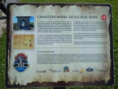
Chantier Naval de Île-aux-Noix
The Île-aux-Noix Naval Shipyard
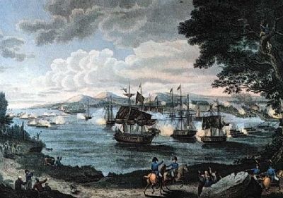
When war was declared between the United States and England, in June of 1812, Canada again risked being attacked from the south. The Lake Champlain-Richelieu River corridor represented the easiest way to invade Montrêal. Île-aux-Noix quickly acquired key strategic significance. Sir George Prevost, then governor-in-chief of British North America chose to act swiftly. As the Americans and British raced for military supremacy on Lake Champlain, the naval shipyard of Île-aux-Noix developed rapidly. Construction activity reached its peak in the summer of 1814 with the launch of the Confiance, a 12000 ton, 36 gun brigantine. In September 1814, while not quite completed, the vessel took part in an important naval battle in the Bay of Plattsburgh. Captured by the Americans, the ship lost its anchor as well 15 of its cannons that rapidly sank to the bottom of Lake Champlain. One of its anchors , salvaged from the water in 1996, can be admired in the entrance hall of Plattsburgh City Hall. The shipbuilding continued during the year that followed the war. The garrison was reduced throughout the 1820s, until finally, in 1834, the naval shipyard of Île-aux-Noix was shut down completely. Between 1819 and 1829, the British erected am imposing new stone military fortification, complete with moats, renaming the site “Fort Lennox”.
French:
En juin 1812, à la suite de la déclaration de guerre entre les États-Unis et l’Angleterre, le Canada se retrouve encore une fois en danger d’être attaqué par le sud. Le corridor Lac Champlain-Rivière Richelieu représente la route d’invasion la plus facile vers Montréal. La position stratégique de l’Île-aux-Noix prend alors une importance capitale. Sir George Prévost, gouverneur en chef de l’Amérique de Nord britannique, décide d’agir rapidement.
La chantier de construction navale de l’Île-aux-Noix se développe au rythme de la course que se livrent Américains et Britanniques pour la suprématie navale sur le Lac Champlain. L’activité de construction atteint son point culminant à l’été de 1814, lors du lancement du brigantin Confiance, jaugeant 12 000 tonneaux et doté de 35 pièces d’artillerie.
En septembre 1814, à peine terminé, ce bâtiment prend part à l’importante bataille navale de la baie de Plattsburgh. Capture par les Américains, le navire perd ses ancres ainsi que 15 de ses cannons qu'il calent rapidement un fond du Lac Champlain. L’une des ancres fut repêchée en 1996. Elle peut être admirée dans le grand hall de l’Hôtel de Ville de Plattsburgh.
La construction de navires continua durant l’année qui suivi la fin de la guerre. Au fil des années 1920, la garnison fut graduellement réduite en finalement, en 1834, le chantier naval de l’Île-aux-Noix ferme ses portes.
Entre 1819 et 1829, les Britanniques construisirent une imposante fortification munie de douves qu’ils renomment le Fort Lennox.
Erected by Québec Culture et Communications, Tourisme Saint-Jean-sur-Richelieu. (Marker Number 16.)
Topics. This historical marker is listed in these topic lists: War of 1812 • Waterways & Vessels. A significant historical month for this entry is June 1812.
Location. 45° 7.602′ N, 73° 16.165′ W. Marker is in Saint-Paul-de-l'Île-aux-Noix, Québec, in Le Haut-Richelieu. Marker can be reached from 61st Avenue close to Rue Principale (Québec Route 223). Touch for map. Marker is at or near this postal address: 1 61st Avenue, Saint-Paul-de-l'Île-aux-Noix QC J0J 1G0, Canada. Touch for directions.
Other nearby markers. At least 8 other markers are within 14 kilometers of this marker, measured as the crow flies. Fort Lennox (approx. 0.6 kilometers away); The Royal Navy (approx. 0.7 kilometers away); Caldwell Manor (approx. 7.4 kilometers away); Blockhaus de la Rivière-Lacolle (approx. 8.6 kilometers away); a different marker also named Blockhaus de la Rivière-Lacolle (approx. 8.6 kilometers away); Bataille du Moulin de Lacolle / Battle of the Lacolle Mill (approx. 8.8 kilometers away); Louis Cyr (approx. 9.8 kilometers away); La Bataille d’Odelltown / Battle of Odelltown (approx. 13.2 kilometers away). Touch for a list and map of all markers in Saint-Paul-de-l'Île-aux-Noix.
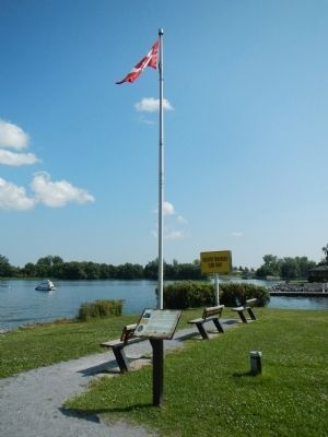
More about this marker. This marker is near the Fort Lennox Visitors Center and ferry dock.
Also see . . . The War of 1812 and the Naval Shipyard - Parks Canada. On the Lake Champlain-Richelieu River front, naval strength was destined to play a major role. In response to the American fleet which patrolled the lake, the British built a naval base and shipyard at île aux Noix. They wasted no time starting up shipbuilding operations. Several warships, including the brig Confiance, were turned out at the île aux Noix shipyards. (Submitted on March 30, 2015, by Barry Swackhamer of Brentwood, California.)
Credits. This page was last revised on June 16, 2016. It was originally submitted on March 30, 2015, by Barry Swackhamer of Brentwood, California. This page has been viewed 399 times since then and 12 times this year. Photos: 1, 2, 3. submitted on March 30, 2015, by Barry Swackhamer of Brentwood, California. • Andrew Ruppenstein was the editor who published this page.


