Macfarlan in Ritchie County, West Virginia — The American South (Appalachia)
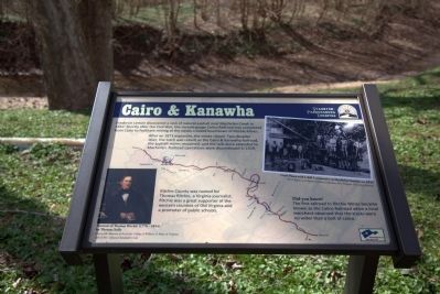
Cairo & Kanawha
— Staunton-Parkersburg Turnpike —
After an 1873 explosion, the mines closed. Two decades later, the track was rebuilt as the Cairo and Kanawha Railroad, the asphalt mines reopened, and the rails were extended to Macfarlan. Railroad operations were discontinued in 1929.
Ritchie County was named for Thomas Ritchie, a Virginia journalist. Ritchie was a great supporter of the western counties of Old Virginia and a promoter of public schools.
Did you know? The first railroad to Ritchie Mines became known as the Calico Railroad when a local merchant observed that the tracks were no wider than a bolt of calico.
Erected by America’s Byways.
Topics. This historical marker is listed in these topic lists: Industry & Commerce • Railroads & Streetcars. A significant historical year for this entry is 1852.
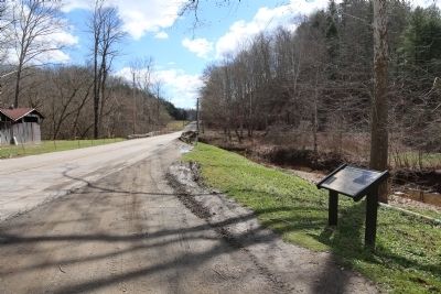
Location. 39° 4.68′ N, 81° 11.893′ W. Marker is in Macfarlan, West Virginia, in Ritchie County. Marker is on Staunton Turnpike (West Virginia Route 47) west of Smithville , on the right when traveling east. Touch for map. Marker is at or near this postal address: 8190 Staunton Tpk, Elizabeth WV 26143, United States of America. Touch for directions.
Other nearby markers. At least 8 other markers are within 10 miles of this marker, measured as the crow flies. Ritchie County / Wirt County (approx. 6.6 miles away); First County Court (approx. 8½ miles away); Burning Springs Oil Field (approx. 8.8 miles away); Destruction of Oil Works (approx. 8.8 miles away); Rathbone Well (approx. 8.8 miles away); Ruble Church (approx. 9.2 miles away); Murder of William B. Dulin (approx. 9.2 miles away); Population Center (approx. 9.2 miles away).
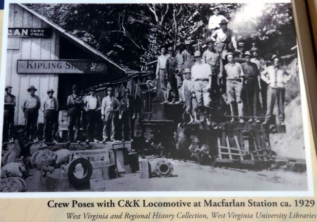
More about this marker. This interpretive panel has a photograph captioned “Crew poses with C&K locomitive at Macfarlan Station ca. 1929” in the upper right. An image captioned “Portrait of Thomas Ritchie (1778-1854) by Thomas Sully” is on the lower left. An image of a map is the background of this panel, showing the Staunton-Parkersburg Turnpike highlighted in red.
Regarding Cairo & Kanawha. The C&K Railroad was a narrow-gauge railroad running between Macfarlan to Cairo, where it met the B&O Railway. Built to carry asphalt and ore from the Ritchie Mines, it is listed on the December 1925 edition of the Official Guide of the Railways of the United States on page 28. A morning train left Cairo for Macfarlan, returning in the afternoon. The one-way time for the 17 mile run was a little under 2 hours. Today, by road, Google Maps reports that the 20 mile trip should take about 34 minutes.
The Official Guide, published monthly, shows passenger timetables for all North American railroads. In the index of railroad lines on page X, the entry reads “Cairo & Kanawha Ry. (Gauge, 3 ft.)” In the index of railroad stations, on page 1433, the entry for Cairo, W.Va shows two railroads, “Balt & O.” (timetable 15) and Cairo & Kanawha. It notes that the passenger stations for the two railroads are adjacent.
The entire timetable entry on page 28 reads “Cairo & Kanawha Railway. Lee Shaffer, President, Cairo, W.Va. — Train leaves Cairo(1) †8:30 a.m., arriving at Macfarlan (16 miles) 10:50 a.m. Returning, leaves Macfarlan †2:30 p.m., arriving Cairo 4:20 p.m. — † Daily, except Sunday. — Connection (1) with Baltimore & Ohio R.R. — March 1925. — Eastern time.”
The C&K ceased operations and was abandoned in 1929. At Cairo, CSX Transportation, the successor railroad to the B&O, abandoned
the tracks through Cairo some years ago. The B&O right-of-way is now the North Bend Rail Trail, a 72 mile trail passing through 13 tunnels and over 36 bridges.
Also see . . .
1. Ritchie County, WV: Calico Road Railroad. Article by Dean Six in the 1973 Ritchie County Historical Society Newsletter. (Submitted on April 1, 2015.)
2. American Narrow Gauge Railroads. This book by George Hilton has an entry for the Cairo & Kanawha Valley Railroad beginning on page 553 (less than one page in length) with a photograph captioned “The Cairo & Kanawha’s mixed train is shown with its Climax geared locomotive at Macfarlan, the southern terminus.” (Submitted on April 1, 2015.)
Credits. This page was last revised on June 16, 2016. It was originally submitted on April 1, 2015, by J. J. Prats of Powell, Ohio. This page has been viewed 1,117 times since then and 55 times this year. Photos: 1, 2, 3. submitted on April 1, 2015, by J. J. Prats of Powell, Ohio.


