Lachine in Montréal in Communauté-Urbaine-de-Montréal, Québec — Central Canada (French-Canadian)
Lachine Massacre
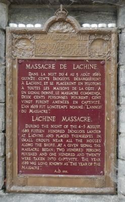
Massacre de Lachine
During the night of the 4-5 August 1689, fifteen hundred Iroquois landed at Lachine and placed themselves in small groups near all the houses along the shore. At a given signal the massacre began; two hundred persons perished and one hundred and twenty were taken into captivity. The year 1689 was long known as "The year of the massacre”.
French:
Dans la nuit du 4 au 5 août 1689, quinze cents Iroquois débarquèrent à Lachine et se placèrent en pelotons à toutes les maisons de la côte. A un signal donné, le massacre commença. Deux cents personnes périrent; cent vingt furent amenées en captivité. L'an 1689 fut longtemps nommé;« L'année du Massacre ».
Erected 1935 by Historic Sites and Monument Board of Canada/Commission de lieux et monuments historique du Canada.
Topics. This historical marker is listed in these topic lists: Native Americans • War, French and Indian. A significant historical year for this entry is 1689.
Location. 45° 25.906′ N, 73° 40.527′ W. Marker is in Montréal, Québec, in Communauté-Urbaine-de-Montréal. It is in Lachine. Marker is on Boulevard Saint-Joseph close to 12 Avenue, on the left when traveling east. Touch for map. Marker is at or near this postal address: 1255 Boulevard Saint-Joseph, Montréal QC H8S 2M2, Canada. Touch for directions.
Other nearby markers. At least 8 other markers are within walking distance of this marker. The Hudson's Bay Company in Lachine (here, next to this marker); Lachine: Gateway to the Northwest (here, next to this marker); Frances Anne Hopkins (a few steps from this marker); Robert Cavelier de la Salle (approx. 0.4 kilometers away); The Lachine Canal (approx. 0.4 kilometers away); A Wonderful New Addition (approx. half a kilometer away); An Upstream Battle (approx. half a kilometer away); Full Steam Ahead (approx. half a kilometer away). Touch for a list and map of all markers in Montréal.
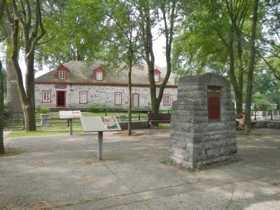
More about this marker. This monument is opposite the Fur Trade at Lachine National Historic Site building, across the Lachine Canal.
Also see . . .
1. Lachine Massacre - Wikipedia. The Lachine massacre, part of the Beaver Wars, occurred when 1,500 Mohawk warriors attacked by surprise the small, 375-inhabitant, settlement of Lachine, New France at the upper end of Montreal Island on the morning of August 5, 1689. The attack was precipitated by growing Iroquois dissatisfaction with the increased French incursions into their territory, and was encouraged by the settlers of New England as a way to leverage power against New France during King William's War. (Submitted on April 1, 2015, by Barry Swackhamer of Brentwood, California.)
2. Beaver Wars (1642-1698). The French and Iroquois Wars (also called the Iroquois Wars or the Beaver Wars) were an intermittent series of conflicts fought in the late 17th century in eastern North America, in which the Iroquois sought to expand their territory and take control of the role of middleman in the fur trade between the French and the more primitive tribes of the west. The conflict pitted the nations of the Iroquois Confederation, led by the dominant Mohawk tribe, against the largely Algonquin tribes of the area and their French allies. The wars were ones of extreme brutality on both sides and considered one of the bloodiest series of conflicts in the history of North America. (Submitted on April 1, 2015, by Barry Swackhamer of Brentwood, California.)
Credits. This page was last revised on February 9, 2023. It was originally submitted on April 1, 2015, by Barry Swackhamer of Brentwood, California. This page has been viewed 1,996 times since then and 177 times this year. Photos: 1, 2. submitted on April 1, 2015, by Barry Swackhamer of Brentwood, California. • Andrew Ruppenstein was the editor who published this page.

