Crittenden in Grant County, Kentucky — The American South (East South Central)
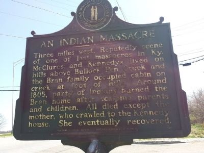
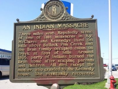
An Indian Massacre
Erected 1966 by Kentucky Historical Society/ Kentucky Department of Highways. (Marker Number 936.)
Topics and series. This historical marker is listed in these topic lists: Native Americans • Wars, US Indian. In addition, it is included in the Kentucky Historical Society series list. A significant historical year for this entry is 1805.
Location. 38° 47.306′ N, 84° 36.461′ W. Marker is in Crittenden, Kentucky, in Grant County. Marker is on Violet Rd (Kentucky Route 491), on the left when traveling west. Touch for map. Marker is in this post office area: Crittenden KY 41030, United States of America. Touch for directions.
Other nearby markers. At least 8 other markers are within 11 miles of this marker, measured as the crow flies. Walton CCC Camp Bean Ridge (approx. 5.2 miles away); Walton-Verona Veterans Memorial (approx. 5.4 miles away); Walton Vernona Purple Heart Monument (approx. 5.4 miles away); The Old Church on the Dry Ridge (approx. 7.3 miles away); Skirmish at Snow’s Pond (approx. 8 miles away); Richwood Presbyterian Church (approx. 8 miles away); Major John P. Gaines (approx. 8.1 miles away); Big Bone Lick (approx. 10.3 miles away).
More about this marker. West side looking east is faded on the lettering, some fading as well. East facing west, clearly visible.
Credits. This page was last revised on June 16, 2016. It was originally submitted on April 5, 2015, by Douglas Williams of Dayton, Ohio. This page has been viewed 2,147 times since then and 92 times this year. Photos: 1, 2. submitted on April 5, 2015, by Douglas Williams of Dayton, Ohio. • Andrew Ruppenstein was the editor who published this page.
Editor’s want-list for this marker. A wide shot of the marker showing it and its surroundings • Can you help?

