Lachine in Montréal in Communauté-Urbaine-de-Montréal, Québec — Central Canada (French-Canadian)
Growing With the Times
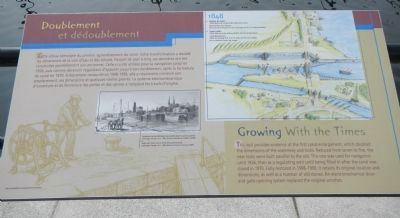
Doublement et dédoublement

Photographed By Barry Swackhamer, August 5, 2014
1. Growing With the Times Marker
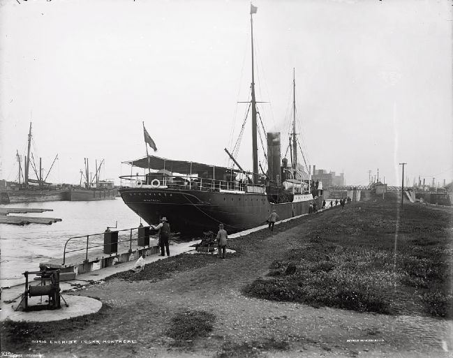
Captions (English / French): (center left) Ships await their turn to enter the Lachine Canal. / Quelques navires attendant leur entrée dans le canal à Lachine.; (illustration on right) 1848 Canal Width: 120 ft (36.6 m) at the surface and 80 ft. (24.4 m) at the bottom. Lock dimensions: 200ft. (61 m) long, 45 ft (13.7 m) wide and 9 ft (2.7 m) deep. / Largeur du canal: 120 pi (36.6 m) en surface et 80 pi (24.4 m) au fond. Dimensions des écluses: 200 pi (61 m) de long, 45 pi (13.7 m) de large et 9 pi (2.7 m) de profondeur.
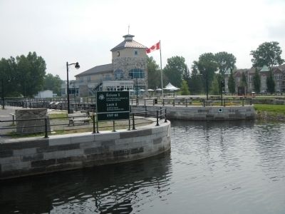
This lock provides evidence of the first canal enlargement, which doubled the dimensions of the waterway and locks. Reduced from seven to five, the new locks were built parallel to the old. this one was used for navigation until 1926, then as a regulating weir until the being filled in after the canal was closed in 1970. Fully restored in 1998-1999, it retains its original location and dimensions, as well as a number of old stones. An electromechanical door-and-gate-opening system replaced the original winches.
French:
Cette écluse témoigne du premier agrandissement du canal. Cette transformation a doublé les dimensions de la voie d’eau et des écluses. Passant de sept à cinq, ces dernières ont été construites parallèlement aux anciennes. Celle-ci a été utilisée pour la navigation jusqu’en 1926, puis comme déversoir régulateur d’appoint jusqu’à son comblement, après la fermeture du canal en 1970. entièrement restaurée en 1998-1999, elle a néanmoins conservé son emplacement, ses dimensions et quelques vieilles pierres. Le système électromécanique d’ouverture et de fermeture des portes et des vannes a remplacé les treuils d’origine.
Erected by Parks Canada / Parcs Canada.
Topics. This historical marker is listed in this topic list: Waterways & Vessels . A significant historical year for this entry is 1926.
Location. 45° 25.867′ N, 73° 40.132′ W. Marker is in Montréal, Québec, in Communauté-Urbaine-de-Montréal. It is in Lachine. Marker can be reached from Boulevard Saint-Joseph close to Chemin du Musée, on the left. Touch for map. Marker is at or near this postal address: 600 Boulevard Saint-Joseph, Montréal QC H8S 2M1, Canada. Touch for directions.
Other nearby markers. At least 8 other markers are within walking distance of this marker. Full Steam Ahead (here, next to this marker); An Upstream Battle (within shouting distance of this marker); A Wonderful New Addition (within shouting distance of this marker); The Lachine Canal (about 120 meters away, measured in a direct line); Frances Anne Hopkins (approx. half a kilometer away); The Hudson's Bay Company in Lachine (approx. half a kilometer away); Lachine: Gateway to the Northwest (approx. half a kilometer away); Lachine Massacre (approx. half a kilometer away). Touch for a list and map of all markers in Montréal.
More about this marker. This marker is across the canal from the Lachine Canal Visitors Center.
Credits. This page was last revised on February 9, 2023. It was originally submitted on April 5, 2015, by Barry Swackhamer of Brentwood, California. This page has been viewed 307 times since then and 5 times this year. Photos: 1, 2. submitted on April 5, 2015, by Barry Swackhamer of Brentwood, California. 3. submitted on April 26, 2015. • Andrew Ruppenstein was the editor who published this page.

