Knoxville in Knox County, Tennessee — The American South (East South Central)
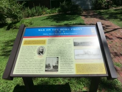
War on the Home Front
Mabry-Hazen House and Bethel Cemetery
— Knoxville Campaign —
On November 4, 1863, Confederate Gen. James Longstreet led two reinforced divisions from Chattanooga to attack Union Gen. Ambrose E. Burnside’s garrison at Knoxville. Burnside confronted Longstreet below Knoxville, then withdrew on November 17. Longstreet followed, besieging the city. In Chattanooga, Union Gen. Ulysses S. Grant’s army defeated Confederate Gen. Braxton Bragg’s forces at the end of the month. Grant ordered Gen. William T. Sherman to reinforce Burnside. Longstreet withdrew on December 4, as Sherman’s 25,000 men approached. Sherman soon rejoined Grant.
(main text)
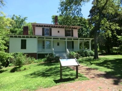
This is the Mabry-Hazen House. Early in September 1863, when Union Gen. Ambrose E. Burnside occupied Knoxville, Capt. Samuel H. Lunt, assistant quartermaster, established his headquarters in the house. Like many Knoxville businessmen during the Federal occupation, owner Joseph A. Mabry—an outspoken supporter of the Confederacy—signed an oath of loyalty to the United States. Federal troops built fortifications here on Mabry’s property, and his wife, Laura C. Mabry, later drew a sketch of the earthworks that crisscrossed the tract. Mabry’s Hill became the eastern anchor of the Union defensive network north of the Holston River. After the Battle of Knoxville in November 1863, Burnside named the works northeast of here Fort Hill in honor of Capt. John W. Hill, 12th Kentucky Cavalry, who had died in the fighting.
At the foot of Mabry’s Hill, local residents later established Bethel Cemetery, which contains remains of more than 1,600 Confederate soldiers. Those who died in the assault on Fort Sanders on November 29 are buried there; however, most of the interred died of disease in the camps and military hospitals around Knoxville. The cemetery also contains the remains of about fifty prisoners and twenty veterans who died after the war. The names of 1,465 of these men are recorded on the undertaker’s list. In 1892, the Ladies’ Memorial Association dedicated a Confederate monument that still stands in the cemetery.
(sidebar)
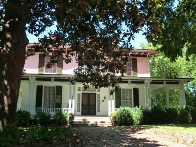
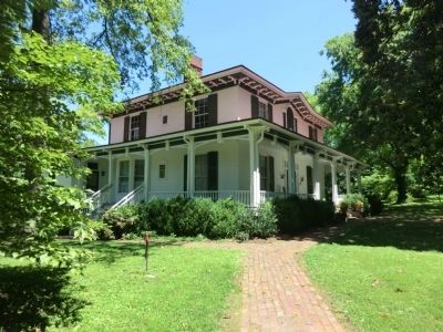
This Italianate-style dwelling helps to tell the story of the effects of the Civil War on the Knoxville home front. The house was completed for Joseph Alexander Mabry II and his wife, Laura Churchwell Mabry, just three years before the war began. Joseph Mabry received the honorary title of General for donating an estimated $100,000 to outfit local Confederate soldiers. Confederate Gen. Felix Zollicoffer established his headquarters here in 1861. A Confederate supply depot also operated on the property, and a garrison was posted there to protect it.
(captions)
Joseph A. Mabry, ca. 1880
Confederate monument, ca. 1895
“Knoxville from Mabry’s House,” March 1864 looking east Courtesy Library of Congress
“Home after War showing Fort and Ditches,” ca. 1865, by Laura C. Mabry
All images courtesy Hazen Historical Museum Foundation
Erected by Tennessee Civil War Trails.
Topics and series. This historical marker is listed in these topic lists: Cemeteries & Burial Sites • Forts and Castles • War, US Civil. In addition, it is included in the Tennessee Civil War Trails series list. A significant historical year for this entry is 1863.
Location. 35° 58.3′ N, 83° 54.2′ W. Marker is in Knoxville, Tennessee, in Knox County. Marker can be reached from the intersection of Dandridge Avenue and Rosedale Avenue, on the right when traveling west. Located in front of the Mabry-Hazen House Museum. Touch for map. Marker is at or near this postal address: 1711 Dandridge Avenue, Knoxville TN 37915, United States of America. Touch for directions.
Other nearby markers. At least 8 other markers are within walking distance of this marker. St. Clair Cobb (approx. 0.2 miles away); Confederate Cemetery (approx. 0.2 miles away); William Francis Yardley (approx. 0.2 miles away); Odd Fellows Cemetery (approx. 0.4 miles away); Ruth Valeria Cobb Brice (approx. half a mile away); Ruth Cobb Brice (approx. half a mile away); Magnolia Avenue History (approx. half a mile away); Knoxville (approx. 0.6 miles away). Touch for a list and map of all markers in Knoxville.
Also see . . . Mabry-Hazen House Museum. (Submitted on October 21, 2013.)
Credits. This page was last revised on June 16, 2016. It was originally submitted on October 19, 2013, by Don Morfe of Baltimore, Maryland. This page has been viewed 702 times since then and 15 times this year. Last updated on April 7, 2015, by J. Makali Bruton of Accra, Ghana. Photos: 1, 2, 3, 4. submitted on October 19, 2013, by Don Morfe of Baltimore, Maryland. • Bill Pfingsten was the editor who published this page.


