Lafayette in Macon County, Tennessee — The American South (East South Central)
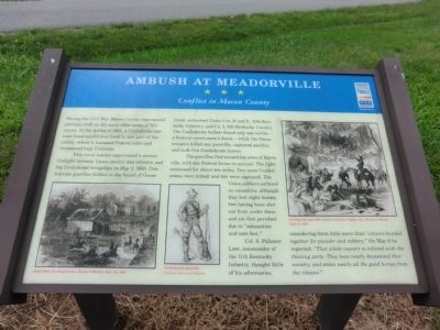
Ambush at Meadorville
Conflict in Macon County
This rural hamlet experienced a serious firefight between Union cavalry and infantry and the Confederate irregulars on May 2, 1863. Confederate guerillas hidden in the brush of Goose Creek ambushed Union Cos. D and E, 11th Kentucky Infantry, and Co. I, 8th Kentucky Cavalry. The Confederate bullets found only one victim—a Federal cavalryman’s horse—while the Union troopers killed one guerrilla, captured another, and took five Confederate horses.
The guerillas fled toward the town of Hartsville, with the Federal forces in pursuit. The fight continued for about ten miles. Two more Confederates were killed, and ten captured. The Union soldiers suffered no casualties although they lost eight horses, two having been shot out from under them and six that perished due to "exhaustion and sore feet."
Col. S. Pallance Love, commander of the 11th Kentucky Infantry, thought little of his adversaries, considering them little more than "citizens banded together for plunder and robbery." On May 6 he reported: "That whole country is infested with the thieving party. They have nearly devastated that country, and stolen nearly all the good horses from the citizens."
(captions)
Guerrillas stealing horses, Harper's Weekly, Dec. 24, 1864
Confederate guerrilla Courtesy Library of Congress
Confederate guerrilla attack on Union wagon train, Harper's Weekly, Sept 5, 1863
Erected by Tennessee Civil War Trails.
Topics and series. This historical marker is listed in this topic list: War, US Civil. In addition, it is included in the Tennessee Civil War Trails series list. A significant historical month for this entry is May 1865.
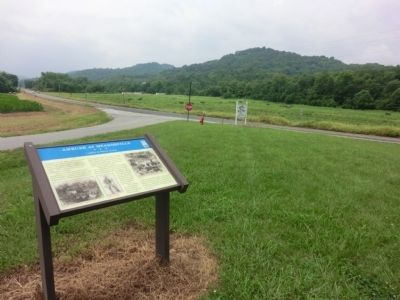
Location. 36° 28.4′ N, 86° 2.517′ W. Marker is in Lafayette, Tennessee, in Macon County. Marker is at the intersection of Ferguson Hill Road and Hartsville Road (Tennessee Route 10), on the left when traveling east on Ferguson Hill Road. Touch for map. Marker is in this post office area: Lafayette TN 37083, United States of America. Touch for directions.
Other nearby markers. At least 8 other markers are within 4 miles of this marker, measured as the crow flies. The Home of William Dunn (approx. 3.3 miles away); A Family Tragedy (approx. 3.3 miles away); Russell Smith (approx. 3.4 miles away); Macon County in the Civil War (approx. 3.4 miles away); Macon County Confederate Soldiers Monument (approx. 3.4 miles away); Woodmore Hotel (approx. 3.4 miles away); Macon County War Memorial (approx. 3.4 miles away); Macon County (approx. 3.4 miles away). Touch for a list and map of all markers in Lafayette.
Credits. This page was last revised on June 9, 2020. It was originally submitted on September 8, 2013, by Don Morfe of Baltimore, Maryland. This page has been viewed 838 times since then and 24 times this year. Last updated on June 9, 2020, by Don Morfe of Baltimore, Maryland. Photos: 1, 2, 3, 4. submitted on September 8, 2013, by Don Morfe of Baltimore, Maryland. • J. Makali Bruton was the editor who published this page.


