Near Whiteside in Marion County, Tennessee — The American South (East South Central)
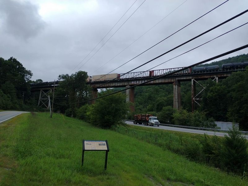
Running Water Creek Bridge
Chickamauga Campaign Heritage Trail
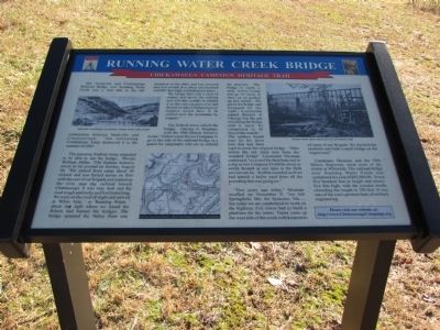
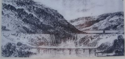
The pursuing Federal Army expected to be able to use the bridge. Private William Miller, 75th Indiana Infantry, wrote in his journal on Sunday, August 30, "We started from camp about 10 o'clock and was ferried across on flats with the rest of our brigade and started up the river near the railroad toward Chattanooga. It was very dark and the road rough and rocky and hard marching. We were on the road all night and arrived at "White Side, ' or 'Running Water, ' about day light where we found the Rebels had burned the bridges. The bridge spanned the Valley from one mountain to the other and was covered and iron roofed. It is about one hundred and fifty feet high at [the]highest place... The bridge here cost a mint of money and serves the railroad and will take months to rebuild it so the cars can pass over and should we take Chattanooga our supplies would have to be carried over the mountains by wagons."
The Federal Army rebuilt the bridge. Chesley A. Mosman, with the 59th Illinois Infantry, wrote: "Orders came for our Company to go to the side of the railroad bridge as a guard for carpenters who are to rebuild the structure. The bridge is nearly a mile below camp and go we must, at once, so we packed up and started...We got to the bridge and arranged for the night...A contractor named Boomer of Chicago has the job of rebuilding the bridge and it must be completed in 40 days at the outside." The soldiers found uses for the sheet iron that had been used to cover the original bridge. Men utilize the old sheet iron from the wrecked bridge" Lieutenant Mosman continued, "as a roof for their huts and in a day or two Company D will be about as cozily housed as any men in the field service can be. It often sounded as if we had started a boiler yard from all the pounding that was going on."
"Two years ago today," Mosman recalled on November 9, "we left Springfield, Mo. for Syracuse, Mo. but today we are condemned to work on the highway. Col. Grose had us build a platform for the trains. Trains came up the west side of the creek with knapsacks of some of our Brigade. We finished the platform and built a small bridge on the wagon road."
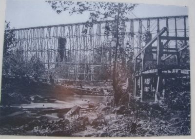
Lieutenant Mosman and the 59th Illinois Regiment, spent most of the winter at Whiteside. The railroad bridge over Running Water Creek was completed at a cost of $95,000.00 It was five hundred feet in length and ninety-five feet high, with the wooden trestle extending the length to 780 feet. It was one of the war's greatest feats of military
engineering.
Erected by Chickamauga Campaign Heritage Trail.
Topics and series. This historical marker is listed in this topic list: War, US Civil. In addition, it is included in the Chickamauga Campaign Heritage Trail series list. A significant historical month for this entry is November 1899.
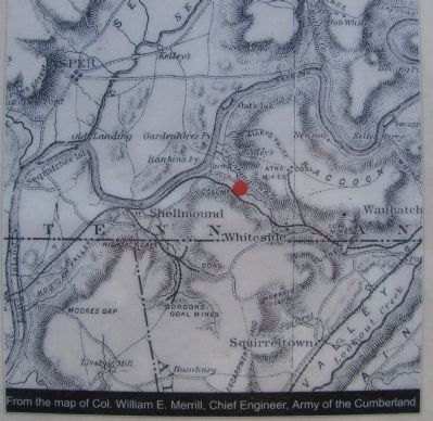
Location. 35° 0.109′ N, 85° 30.7′ W. Marker is near Whiteside, Tennessee, in Marion County. Marker is on J E Clouse Highway (Tennessee Route 134) 2 miles east of Shellmound Road (Tennessee Route 156), on the right when traveling east. Touch for map. Marker is in this post office area: Whiteside TN 37396, United States of America. Touch for directions.
Other nearby markers. At least 8 other markers are within 6 miles of this marker, measured as the crow flies. Federal-Georgia Road (approx. 2 miles away); Civil War in Tennessee (approx. 3.1 miles away); Location and Capacity (approx. 3.4 miles away); Hales Bar Dam (approx. 3.4 miles away); Cole Plantation and Bethlehem Cemetery (approx. 4.6 miles away in Georgia); Cole Plantation and Academy (approx. 5.3 miles away in Georgia); Love's Ferry (approx. 5˝ miles away); Ebenezer Cumberland Presbyterian Church (approx. 5.7 miles away).
Additional commentary.
1. Tennessee Civil War Trails
From the Tennessee Civil War Trails map for Southeast Tennessee sites: "The Nashville
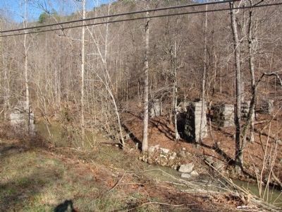
and Chattanooga Railroad erected the stone bridge abutments, visible just north of the highway, after the Civil War. The site, however, marks the location of a railroad bridge that was a vital strategic link between Nashville and Chattanooga. The Confederates destroyed the first Running Water Creek bridge in 1863. Federal engineers replaced it with an engineering marvel, an almost 100-foot high wooden trestle bridge, and soon reopened the railroad. Federal troops occupied the area, protecting the bridge for the remainder of the fighting."
— Submitted January 11, 2011, by Lee Hattabaugh of Capshaw, Alabama.
Credits. This page was last revised on September 2, 2022. It was originally submitted on January 10, 2011, by Lee Hattabaugh of Capshaw, Alabama. This page has been viewed 2,498 times since then and 88 times this year. Last updated on April 8, 2015, by J. Makali Bruton of Accra, Ghana. Photos: 1, 2, 3, 4. submitted on January 10, 2011, by Lee Hattabaugh of Capshaw, Alabama. 5. submitted on September 1, 2022, by Tom Bosse of Jefferson City, Tennessee. 6. submitted on January 11, 2011, by Lee Hattabaugh of Capshaw, Alabama. • Bill Pfingsten was the editor who published this page.
