Stony Point in Rockland County, New York — The American Northeast (Mid-Atlantic)
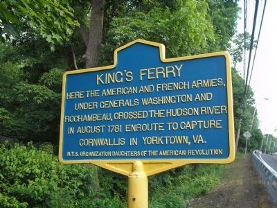
King’s Ferry
Inscription.
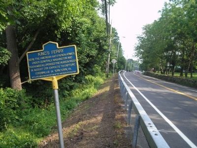
Here the American and French armies, under Generals Washington and Rochambeau, crossed the Hudson River in August 1781 enroute to capture Cornwallis in Yorktown, Va.
Erected by Daughters of the American Revolution.
Topics and series. This historical marker is listed in these topic lists: Notable Places • War, US Revolutionary. In addition, it is included in the Daughters of the American Revolution, the Former U.S. Presidents: #01 George Washington, and the The Washington-Rochambeau Route series lists. A significant historical year for this entry is 1781.
Location. 41° 14.606′ N, 73° 59.173′ W. Marker is in Stony Point, New York, in Rockland County. Marker is at the intersection of N Liberty Drive (U.S. 9W) and Lighthouse Ct., on the right when traveling north on N Liberty Drive. Touch for map. Marker is in this post office area: Stony Point NY 10980, United States of America. Touch for directions.
Other nearby markers. At least 8 other markers are within walking distance of this marker. Buckberg Mountain Road (approx. 0.3 miles away); Stony Point Battlefield (approx. 0.4 miles away); Stony Point State Park (approx. half a mile away); Intrigue at King’s Ferry (approx. 0.6 miles away); The Path to Victory (approx. 0.6 miles away); A Crucial Crossing (approx. 0.6 miles away); Fraser’s Highlanders (approx. 0.6 miles away); Stony Point Battlefield State Historic Site (approx. 0.6 miles away). Touch for a list and map of all markers in Stony Point.
Also see . . . King's Point. A Revolutionary Day website entry (Submitted on August 22, 2021, by Larry Gertner of New York, New York.)

Photographed By Bill Coughlin, June 7, 2008
2. Marker on N Liberty Drive
King's Ferry was the closest crossing point on the Hudson River to British-occupied New York City. It served as a transfer point for American troops, supplies and communications throughout the war, and was the scene of several military engagements.
Credits. This page was last revised on August 22, 2021. It was originally submitted on June 8, 2008, by Bill Coughlin of Woodland Park, New Jersey. This page has been viewed 1,553 times since then and 75 times this year. Photos: 1, 2. submitted on June 8, 2008, by Bill Coughlin of Woodland Park, New Jersey. 3. submitted on September 20, 2008, by Bill Coughlin of Woodland Park, New Jersey.

