Adams in Robertson County, Tennessee — The American South (East South Central)
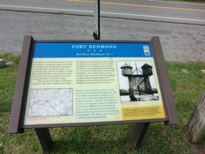
Fort Redmond
Red River Blockhouse No. 1
With the fall of Forts Henry and Donelson in February 1862, the Confederates abandoned Fort Redmond, and Union troops occupied the area. The Federals also recognized the value of these railroad and river fortifications. They restored the bridges and established Red River Blockhouse No. 1 to secure the trestle and the rails that cross the Red River. The wooden structure was constructed of heavy timber, two feet thick, designed to withstand attack by light weapons. The blockhouse, however, did not face any significant Confederate assaults for the rest of the war.
“Monday, Aug 18—Federal Troops pressed seven men to help build RR bridge over the Red River which the Southern soldiers burnt partly up on Saturday night also pressed wagon and team. …Aug 22—The Southern Cavalry 120 in number under Col. Woodard attacked the Federals 80 in number and after a short skirmish captured them all, released them on parole burnt the bal(ance) of the bridge—The Negroes all ran home.” — J.W. Fort farm journal, 1862
(sidebar
The Red River provided water, fish, and transportation for travelers and settlers. The Edgefield and Kentucky Railroad Company constructed the first bridge across the Red River by February 1859 for $82,345. The limestone piers that supported the bridge are still visible, and remnants of earthworks remain on the southern ridge.
(captions)
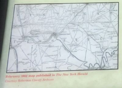
February 1862 map published in The New York Herald — Courtesy Robertson County Archives
Middle Tennessee Blockhouse Courtesy Robertson County Archives
Erected by Tennessee Civil War Trails.
Topics and series. This memorial is listed in these topic lists: Forts and Castles • Railroads & Streetcars • War, US Civil. In addition, it is included in the Tennessee Civil War Trails series list.
Location. 36° 34.833′ N, 87° 3.633′ W. Marker is in Adams, Tennessee, in Robertson County. Memorial is on U.S. 41 east of Keysburg Road (County Route 1884), on the right when traveling west. Touch for map. Marker is at or near this postal address: 7617 US 41, Adams TN 37010, United States of America. Touch for directions.
Other nearby markers. At least 8 other markers are within 5 miles of this marker, measured as the crow flies. Bell Witch (here, next to this marker); Adams War Memorial (a few steps from this marker); Red River Church (approx. 0.3 miles away); Joseph W. Byrns (approx. 2.3 miles away); Camp Cheatham (approx. 3.9 miles away); Stores of Port Royal (approx. 4.9 miles away); 1859 Masonic Lodge & General Store (approx. 4.9 miles away); The Town of Port Royal (approx. 4.9 miles away). Touch for a list and map of all markers in Adams.
Credits. This page was last revised on June 16, 2016. It was originally submitted on September 12, 2013, by Don Morfe of Baltimore, Maryland. This page has been viewed 1,138 times since then and 63 times this year. Last updated on April 10, 2015, by J. Makali Bruton of Accra, Ghana. Photos: 1, 2, 3. submitted on September 12, 2013, by Don Morfe of Baltimore, Maryland. • Bill Pfingsten was the editor who published this page.


