Frederick in Frederick County, Maryland — The American Northeast (Mid-Atlantic)
Caught in the Crossfire
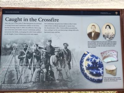
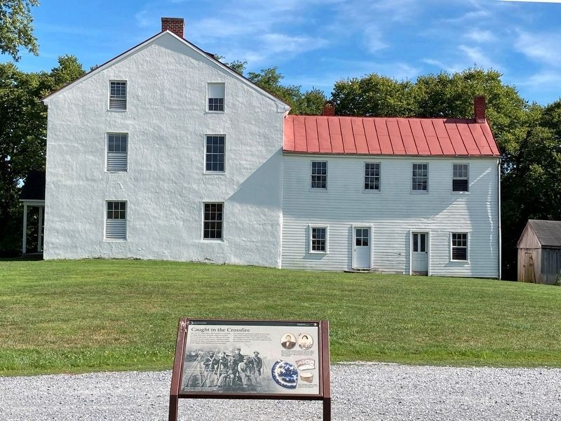
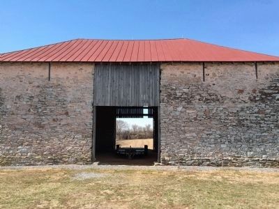
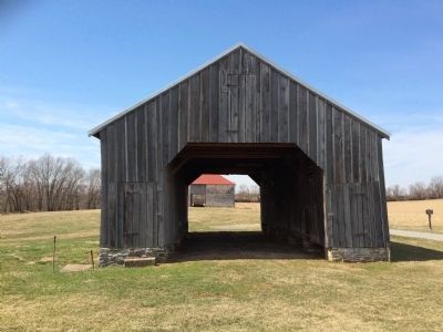
Since the war's onset John T. Best had grown accustomed to seeing Union and Confederate soldiers on his farm, but the morning of July 9, 1864, was different. Shots rang out on the farm and a battle ensued. Confederate artillery moved into the fields, exchanging fire with Union artillery on the heights. Union infantrymen were easy targets for Confederate sharpshooters hidden in Best's barn until a Union artillerist spied puffs of smoke from the sharpshooters' rifles. Union artillery pounded the barn, setting it on fire and destroying it along with tools, harvested crops, and hay.
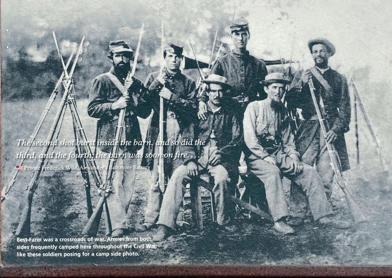
The second shot burst inside the barn, and so did the third, and the fourth; the barn was soon on fire....
Private Frederick Wild, Alexander's Baltimore Battery
(captions)
(lower left) Best Farm was a crossroads of war. Armies from both sides frequently camped here throughout the Civil War, like these soldiers posing for a camp side photo.
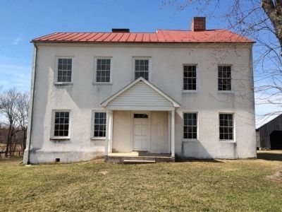
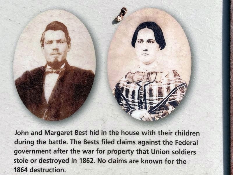
(upper right) John and Margaret Best hid in the house with their children during the battle. The Bests filed claims against the Federal government after the war for property that Union soldiers stole or destroyed in 1862. No claims are known for the 1864 destruction.
(lower right) These fragments of dishes, broken during the 1864 battle, were found buried near the farmhouse.
Erected by Monocacy National Battlefield—National Park Service—U.S. Department of the Interior.
Topics. This historical marker is listed in these topic lists: Military • War, US Civil. A significant historical date for this entry is July 9, 1864.
Location. 39° 22.234′ N, 77° 23.92′ W. Marker is in Frederick, Maryland, in Frederick County. Marker can be reached from Urbana Pike (Route 355) 0.4 miles south of New Technology Way, on the right when traveling south. This marker is located near the parking lot on the Best Farm, stop 1 on the Auto-Tour route. Touch for map. Marker is at or near this postal address: 5201 Urbana Pike, Frederick MD 21703, United States of America. Touch for directions.
Other nearby markers. At least 8 other markers are within walking distance of this marker. L'Hermitage (here, next to this marker); The Lost Order (here, next to this marker); 1862 Antietam Campaign (here, next to this marker); 14th New Jersey Infantry Regiment (approx. 0.3 miles away); Commemoration (approx. 0.3 miles away); Federals Take a Stand (approx. 0.3 miles away); Nick of Time (approx. 0.4 miles away); A Crossroads of History (approx. 0.4 miles away). Touch for a list and map of all markers in Frederick.
Related marker. Click here for another marker that is related to this marker. This replaces the original "Best Family Farm" wayside at this location.
Also see . . . Monocacy National Battlefield. National Park Service website entry (Submitted on April 13, 2015.)
Photographed By Allen C. Browne, August 13, 2022
6. John and Margaret Best
John and Margaret Best hid in the house with their children during the battle. The Bests filed claims against the Federal government after the war for property that Union soldiers stole or destroyed in 1862, No claims are known for the 1864 destructions.
Close-up of Photos on marker.
Photographed By Allen C. Browne, August 13, 2022
7. Crossroads of War
The Second shot burst inside the barn, and so did the third, and the fourth, the barn was soon on fire… - Private Frederick Wild, Alexander’s Baltimore Battery.
Best Farm was a crossroads of War. Armies from both sides frequently camped here throughout the Civil War, like these soldiers posing for a camp side photo.
Close up of photo on marker.
Best Farm was a crossroads of War. Armies from both sides frequently camped here throughout the Civil War, like these soldiers posing for a camp side photo.
Credits. This page was last revised on April 8, 2023. It was originally submitted on April 10, 2015, by Shane Oliver of Richmond, Virginia. This page has been viewed 584 times since then and 10 times this year. Last updated on March 28, 2022, by Connor Olson of Kewaskum, Wisconsin. Photos: 1. submitted on April 10, 2015, by Shane Oliver of Richmond, Virginia. 2. submitted on August 14, 2022, by Allen C. Browne of Silver Spring, Maryland. 3, 4, 5. submitted on April 10, 2015, by Shane Oliver of Richmond, Virginia. 6, 7. submitted on August 14, 2022, by Allen C. Browne of Silver Spring, Maryland. • Bernard Fisher was the editor who published this page.
