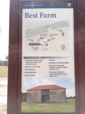
Frederick in Frederick County, Maryland — The American Northeast (Mid-Atlantic)
L'Hermitage
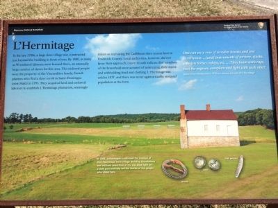
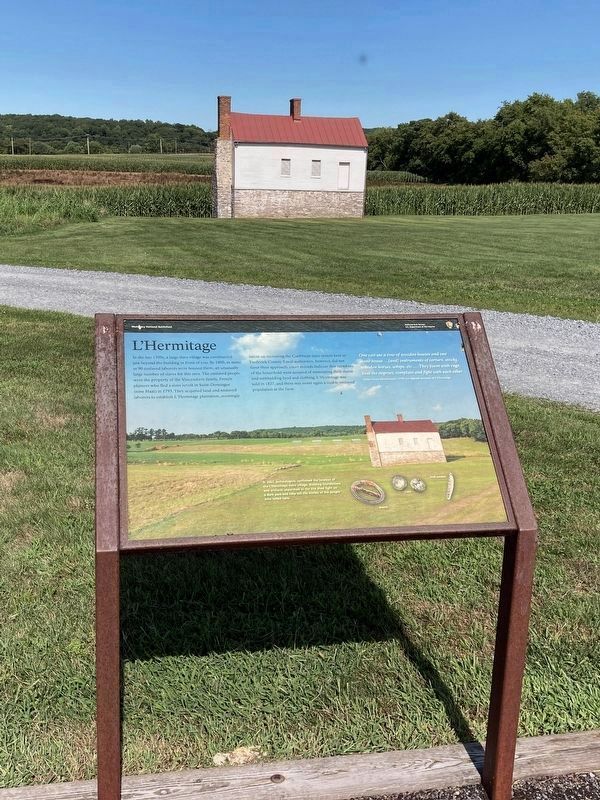
In the late 1700s, a large slave village was constructed just beyond the building in front of you. By 1800, as many as 90 enslaved laborers were housed there, an unusually large number of slaves for this area. The enslaved people were the property of the Vincendière family, French planters who fled a slave revolt in Saint-Domingue (now Haiti) in 1793. They acquired land and enslaved laborers to establish L'Hermitage plantation, seemingly intent on recreating the Caribbean slave system here in Frederick County. Local authorities, however, did not favor their approach; court records indicate that members of the household were accused of mistreating their slaves and withholding food and clothing. L'Hermitage was sold in 1827, and there was never again a sizable slave population at the farm.
One can see a row of wooden houses and one stone house...[and] instruments of torture, stocks, wooden horses, whips, etc....They foam with rage, beat the negroes, complain and fight with each other.
Julian Ursyn Niemcewicz's 1798 eye-witness accounts of L'Hermitage
Caption:
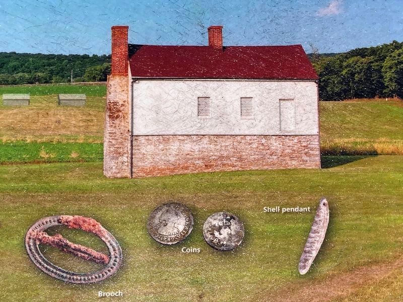
(lower left) In 2003, archeologists confirmed the location of the L'Hermitage slave village. Building foundations and artifacts unearthed at the site shed light on a dark past and help tell the stories of the people who toiled here.
Erected by Monocacy National Battlefield—National Park Service—U.S. Department of the Interior.
Topics. This historical marker is listed in these topic lists: African Americans • Military • War, US Civil. A significant historical year for this entry is 1800.
Location. 39° 22.235′ N, 77° 23.92′ W. Marker is in Frederick, Maryland, in Frederick County. Marker can be reached from Urbana Pike (Maryland Route 355) 0.4 miles south of New Technology Way, on the right when traveling south. This marker is located near the parking lot on the Best Farm, stop 1 on the Auto-Tour route. Touch for map. Marker is at or near this postal address: 5201 Urbana Pike, Frederick MD 21703, United States of America. Touch for directions.
Other nearby markers. At least 8 other markers are within walking distance of this marker. The Lost Order (here, next to this marker); Caught in the Crossfire (here, next to this marker); 1862 Antietam Campaign (here, next to this marker); 14th New Jersey Infantry Regiment (approx. 0.3 miles away); Commemoration (approx. 0.3 miles away); Federals Take a Stand (approx. 0.3 miles away); Nick of Time (approx. 0.4 miles away); A Crossroads of History (approx. 0.4 miles away). Touch for a list and map of all markers in Frederick.
Related marker. Click here for another marker that is related to this marker. This marker replaced an older one at this location titled “Confederates Invade Maryland” .
Also see . . . Monocacy National Battlefield. National Park Service (Submitted on April 13, 2015.)
Photographed By Allen C. Browne, August 13, 2022
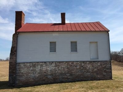
4. Secondary Building
& Archaeological Artifacts
& Archaeological Artifacts
In 2003, archeologists confirmed the location of the L'Hermitage slave village. Building foundations and artifacts unearthed at the site shed light on a dark past and help tell the stories of the people who toiled here.
Close-up of image on Marker
Photographed By Allen C. Browne, August 13, 2022
7. L'Hermitage
a poster at Araby (Thomas Farm).
a poster at Araby (Thomas Farm).
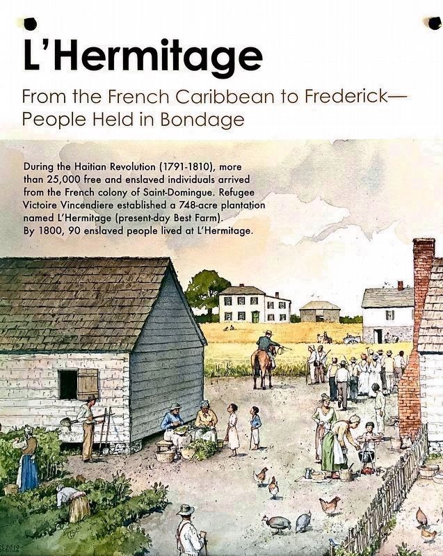
From the French Caribbean to Frederick-
People Held in Bondage
During the Haitian Revolution (1791-1810), more that 250,000 free and enslaved individuals arrived from the French colony of Saint-Domingue. Rufugee Victoire Vincendiere established a 748-acre plantation named L'Hermitage (present-day Best Farm). By 1800, 90 enlaved people lived at L'Hermitage.
Credits. This page was last revised on August 14, 2022. It was originally submitted on April 10, 2015, by Shane Oliver of Richmond, Virginia. This page has been viewed 711 times since then and 31 times this year. Last updated on March 28, 2022, by Connor Olson of Kewaskum, Wisconsin. Photos: 1. submitted on April 10, 2015, by Shane Oliver of Richmond, Virginia. 2. submitted on August 14, 2022, by Allen C. Browne of Silver Spring, Maryland. 3. submitted on April 10, 2015, by Shane Oliver of Richmond, Virginia. 4. submitted on August 14, 2022, by Allen C. Browne of Silver Spring, Maryland. 5, 6. submitted on April 10, 2015, by Shane Oliver of Richmond, Virginia. 7. submitted on August 14, 2022, by Allen C. Browne of Silver Spring, Maryland. • J. Makali Bruton was the editor who published this page.
