Near Valley Head in Randolph County, West Virginia — The American South (Appalachia)
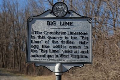
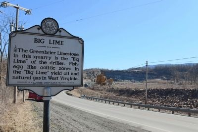
Big Lime
Erected 1963 by the West Virginia Centennial Committee and the Oil and Natural Gas Industry. West Virginia Historic Commission.
Topics and series. This historical marker is listed in these topic lists: Industry & Commerce • Natural Features. In addition, it is included in the West Virginia Archives and History series list.
Location. 38° 32.962′ N, 80° 4.682′ W. Marker is near Valley Head, West Virginia, in Randolph County. Marker is on West Virginia Route 15, 3.6 miles west of U.S. 219, on the right when traveling west. Touch for map. Marker is in this post office area: Valley Head WV 26294, United States of America. Touch for directions.
Other nearby markers. At least 8 other markers are within 7 miles of this marker, measured as the crow flies. Valley Head (approx. 2.3 miles away); The Conley Graves (approx. 3.1 miles away); Mingo Flats (approx. 4.2 miles away); Camp Elkwater (approx. 6.1 miles away); Elkwater / Col. J. A. Washington (approx. 6.1 miles away); Lee's Headquarters (approx. 6.3 miles away); Webster County / Randolph County (approx. 6.3 miles away); Pocahontas County / Randolph County (approx. 6.8 miles away). Touch for a list and map of all markers in Valley Head.
Also see . . .
1. Wikipedia entry for Greenbrier Limestone. The Greenbrier Limestone, also known locally as the “Big Lime,” is an extensive limestone unit deposited during the Middle Mississippian Epoch, part of the Carboniferous Period. This rock stratum is present below ground in much of West Virginia and neighboring Kentucky, and extends somewhat into adjacent western Maryland and southwestern Virginia. The name derives from the Greenbrier River in West Virginia.
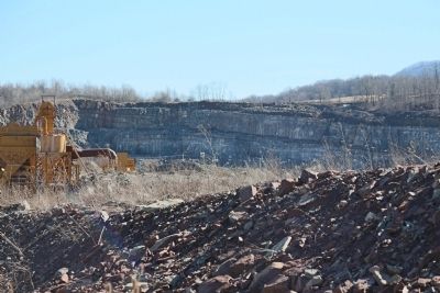
Greenbrier Limestone is in some places more than 400 feet (120 metres) thick, allowing it to trap large quantities of oil and gas. Since this carbonate rock erodes quickly in the region's wet climate, outcrops are not prominent and are often quarried.
The Greenbrier Limestone is subdivided into six stratigraphic units. In ascending order, they are Denmar Limestone, Taggard Shale, Pickaway Limestone, Union Limestone, Greenville Shale, and Alderson Limestone. The limestones in this interval are predominantly skeletal grainstones or packstones. The Pickaway and especially the Union contain oolitic grainstones.
Numerous solution caves are developed within the Greenbrier Formation. (Submitted on April 11, 2015.)
2. Wikipedia entry for Oolite (Egg Stone). Oolite (egg stone) is a sedimentary rock formed from ooids, spherical grains composed of concentric layers. The name derives from the ancient Greek word ̣oion for egg. Strictly, oolites consist of ooids of diameter 0.25–2 mm; rocks composed of ooids larger than 2 mm are called pisolites. The term oolith can refer to oolite or individual ooids. (Submitted on April 11, 2015.)
Credits. This page was last revised on August 21, 2020. It was originally submitted on April 11, 2015, by J. J. Prats of Powell, Ohio. This page has been viewed 752 times since then and 53 times this year. Last updated on August 21, 2020, by Carl Gordon Moore Jr. of North East, Maryland. Photos: 1, 2, 3. submitted on April 11, 2015, by J. J. Prats of Powell, Ohio.


