Fort Sill in Comanche County, Oklahoma — The American South (West South Central)
Camp Doniphan
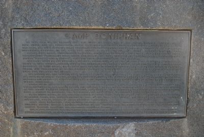
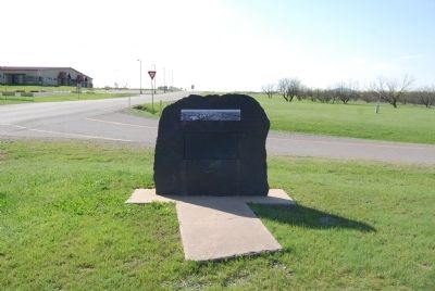
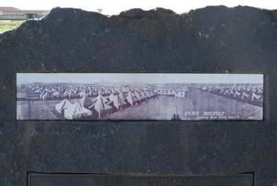
In June 1917, on the prairie west and south of here, one of the great training grounds of the first World War was established. Named in honor of Missouri's Colonel Alexander W. Doniphan of Mexican War fame, the huge national army cantonment occupied 1,200 acres and and was laid out in the form of a horseshoe, opening to the east. This marker is at the site of the north entrance to the camp.
Frame mess halls, storehouses, canteens, and other facilities were erected by the Selden-Breck Construction Company of Saint Louis. The rest of the camp was a city of pyramidal tents, heated by Sibley stoves. "Jitneys" and a trolley line provided transportation to Lawton.
Infantry units of the Oklahoma National Guard, part of the 36th Division commanded by Major General Edwin St. John Greble, trained in the summer of 1917 before joining the division's Texas National Guard elements at Camp Bowie. On 13 September the 35th Division, comprising the Kansas and Missouri National Guard, and commanded by Major General William M. Wright, was activated here, Camp Doniphan was its home for the next six months.
The 50,000 men who trained here would remember with nostalgia the wind, the dust, the heat of summer, the cold of winter in canvas tents, the strenuous drills and marches, and the endless digging of trenches, dugouts, and artillery emplacements in hard-baked soil and harder rock in "no man's land" near Signal Mountain.
Among noted Missourians present were 1st Lieutenant Harry S. Truman, Battery F, 129th Field Artillery, later President of the United States, and Captain Dwight F. Davis, Company L, 136th Infantry, later Secretary of War, Major General Robert M. Danford, last Chief of Field Artillery, commanded the 129th for a period here. A marker on Grierson Hill overlooks the encampment of President Truman's Company F.
In the spring of 1918, to the haunting strain of "Over There," the men of the 35th left for the battlefields of France. There, with their Comrades-in-Arms of the 36th, they fought and died in the Meuse-Argonne offensive, one of history's most decisive campaigns.
After their departure, Camp Doniphan became a field artillery brigade firing centre, commanded by Brigadier General Edmund L. Gruber, composer of the "Caisson Song." In the later years the site was used as the summer training camp for the Oklahoma National Guard.
This plaque, together with the Simpson Gun on Signal Mountain that overlooks the Camp Doniphan area, stand as lasting and grateful memorials to the host of brave soldiers who trained here in freedom's cause in World War One.
Topics and series. This historical marker is listed in this topic list: War, World I. In addition, it is included in the Former U.S. Presidents: #33 Harry S. Truman series list. A significant historical month for this entry is June 1917.
Location. 34° 40.542′ N, 98° 24.972′ W. Marker is in Fort Sill, Oklahoma, in Comanche County. Marker is at the intersection of Randolph Road and Currie Road, on the right when traveling west on Randolph Road. Located on the grounds of Fort Sill, an active U.S. military installation. Appropriate identification is required for access. Touch for map. Marker is in this post office area: Fort Sill OK 73503, United States of America. Touch for directions.
Other nearby markers. At least 8 other markers are within 2 miles of this marker, measured as the crow flies. Cpt Riley L. Pitts (approx. 0.8 miles away); Quinette Crossing (approx. 1.3 miles away); Old Redoubt (approx. 1.4 miles away); Cavalry Company Quarters (approx. 1.7 miles away); Post Guardhouse (approx. 1.7 miles away); Old Post (approx. 1.7 miles away); Sill (approx. 1.7 miles away); Infantry Barracks (approx. 1.7 miles away). Touch for a list and map of all markers in Fort Sill.
Credits. This page was last revised on July 29, 2020. It was originally submitted on April 11, 2015, by Mike Wintermantel of Pittsburgh, Pennsylvania. This page has been viewed 669 times since then and 67 times this year. Photos: 1, 2, 3, 4. submitted on April 11, 2015, by Mike Wintermantel of Pittsburgh, Pennsylvania.


