Kings Canyon National Park in Tulare County, California — The American West (Pacific Coastal)
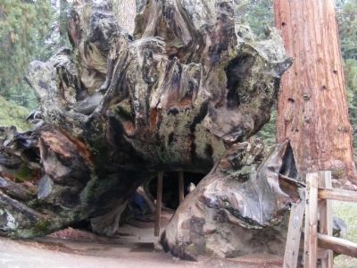
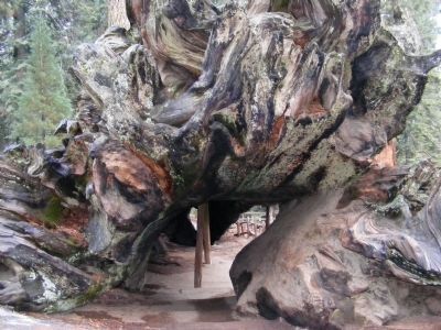
The Fallen Monarch
Kings Canyon National Park
(Left side)
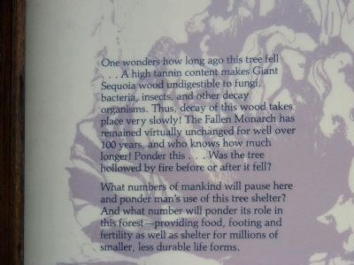
One wonders how long this tree fell...A high tanning content makes Giant Sequoia wood undigestible to fungi, bacteria, insects, and other decay organisms. Thus, decay of this wood takes place very slowly! The Fallen Monarch has remained unchanged for well over 100 years, and who knows how much longer! Ponder this...Was the tree hollowed by fire before or after it fell? What numbers will ponder its role in this forest...providing food, footing and fertility as well as shelter for millions of smaller, less durable life forms.
(Right side)
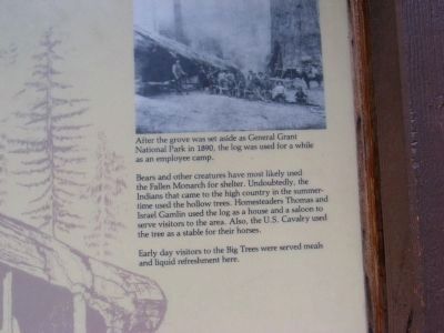
Bears and other creatures have most likely used the Fallen Monarch for shelter. Undoubtedly, the Indians that came to the high country in the summertime used the hollow trees. Homesteaders Thomas and Isreal Gamlin used the log as a house and a saloon to serve visitors to the area. Also, the U.S. Cavalry used the tree as a stable for their horses. Every day visitors to the Big Trees were served meals and liquid refreshment here.
(Inscription)
After the grove was set aside as General Grant National Park in 1890, the log was used for a while as an employee camp.
Erected by National Park Service-United States Department of the Interior.
Topics. This historical marker is listed in this topic list: Horticulture & Forestry. A significant historical year for this entry is 1890.
Location. 36° 44.796′ N, 118° 58.554′ W. Marker is in Kings Canyon National Park, California, in Tulare County. Touch for map. Marker is in this post office area: Kings Canyon National Pk CA 93633, United States of America. Touch for directions.
Other nearby markers. At least 8 other markers are within 9 miles of this marker, measured as the crow flies. General Grant Tree Trail (about 500 feet away, measured in a direct line); The Centennial Stump (about 700 feet away); Gamlin Cabin (about 700 feet away); Millwood (approx. 1.8 miles away); Converse Basin Grove (approx. 2.3 miles away); Technology in Timber County… (approx. 5.3 miles away); Buck Rock Lookout (approx. 6.6 miles away); Dunlap Cemetery (approx. 9 miles away).
Credits. This page was last revised on June 16, 2016. It was originally submitted on April 13, 2015, by Don Morfe of Baltimore, Maryland. This page has been viewed 793 times since then and 42 times this year. Photos: 1, 2, 3, 4, 5, 6. submitted on April 13, 2015, by Don Morfe of Baltimore, Maryland. • Andrew Ruppenstein was the editor who published this page.
