Webster Springs in Webster County, West Virginia — The American South (Appalachia)
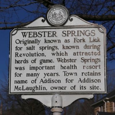
Webster Springs
Topics and series. This historical marker is listed in these topic lists: Animals • Natural Resources • Notable Places • Political Subdivisions • Science & Medicine. In addition, it is included in the West Virginia Archives and History series list.
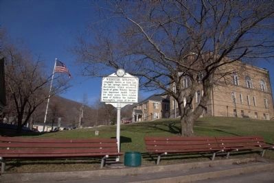
Location. 38° 28.683′ N, 80° 24.756′ W. Marker is in Webster Springs, West Virginia, in Webster County. Marker is at the intersection of Main Street (West Virginia Route 15) and Court Square, on the right when traveling north on Main Street. Touch for map. Marker is in this post office area: Webster Springs WV 26288, United States of America. Touch for directions.
Other nearby markers. At least 8 other markers are within walking distance of this marker. Veterans Memorial (a few steps from this marker); a different marker also named Veterans Memorial (a few steps from this marker); Steven Paul Mollohan (within shouting distance of this marker); Webster County Court Square (within shouting distance of this marker); First National Bank of Webster Springs (within shouting distance of this marker); Coal Block (within shouting distance of this marker); Webster Springs Hotel (within shouting distance of this marker); a different marker also named Webster Springs Hotel (within shouting distance of this marker). Touch for a list and map of all markers in Webster Springs.
More about this marker. The official Postal Service list of post office official and alternate names does not list Addison. It only shows Webster Springs.
Also see . . . Wikipedia Entry. “John Hall, along with a man whose first name is not known, who is only known as Mr. Skidmore, drilled the first salt sulfur well in the county, it was known as lsquo;Old Spring.’The well was later owned by Colonel John T. McGraw. The salt sulfur well helped make Webster Springs a popular summer tourist location during the 19th and early 20th Century. According to Springs in West Virginia, the town of Webster Springs had four total springs, they included: the Addison McLaughlin Well, located to the west of Court Square on the present site of the Mineral Springs Motel, Old Fork Lick Spring, located in the bed of the Elk River, Tracy Well, located on the lot of its owner, W.B. Tracy, in Webster Springs, and the Wm. Smith Well, located
in Dorrtown. The wells were popular because people believed that the water from the wells had medicinal qualities. The water was used to treat skin conditions such as psoriasis, eczema, acne and arthritis.” (Submitted on April 19, 2015.)
Credits. This page was last revised on August 5, 2021. It was originally submitted on April 19, 2015, by J. J. Prats of Powell, Ohio. This page has been viewed 564 times since then and 67 times this year. Photos: 1, 2. submitted on April 19, 2015, by J. J. Prats of Powell, Ohio.

