Lacolle in Le Haut-Richelieu, Québec — Central Canada (French-Canadian)
Blockhaus de la Rivière-Lacolle
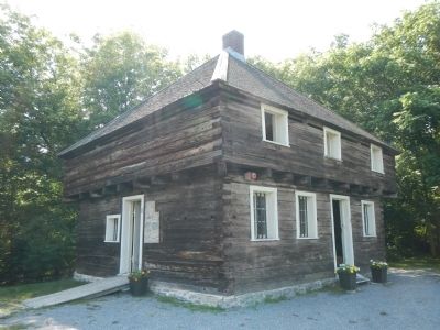
The Lacolle River Blockhouse

Photographed By Barry Swackhamer, August 4, 2014
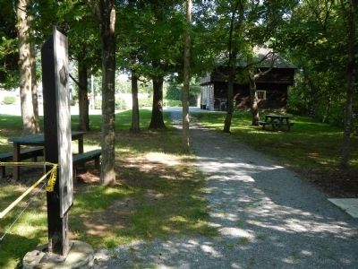
1. Blockhaus de la Rivière-Lacolle Marker
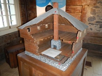
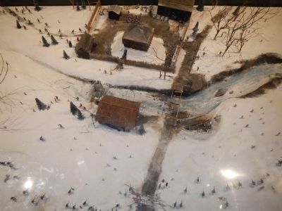
Captions (English / French): (top) A model of the building is on display inside the blockhouse. / Vous trouverez une maquette du bâtiment à l’intérieur du blockhaus.; Fire Place / Foyer; Office / Bureau; Trapdoor / Trappe; Embrasures for cannons / Embrasures pour canons.; (bottom) Blockhouse circa 1930 / Blockhaus vers 1930.
The Lacolle River Blockhouse
Back in the XVIII Century …
In Canada, blockhouses first appeared in Acadia around 1750, at the time of the British conquest. The Lacolle River blockhouse, built in 1781, was part of the colony’s defence network, and served as an outpost for British soldiers on missions in the Upper-Richelieu region. It was abandoned after a peace treaty was signed on December 24, 1814, by the United States and Great Britain, and today is the only blockhouse still remaining in Québec.
Defence outpost
The word “blockhouse” is derived from the German “blockhaus”, meaning house that blocks the way. It served primarily as a rapid defence mechanism for strategic sites. This building has two stories, the second of which is corbelled. The walls have musket loops and, on the upper floor, embrasures for cannons. It was, however, built of wood, a material that was cheap and readily available on the site. The result was a high risk of fire and very poor resistance to artillery attacks.
French:
Le Blockhaus de la Rivière-Lacolle
Dès le XVIIIᵉ siècle …
Au Canada, les blockhaus firent leur apparition en Acadie vers 1750, à l’époque de sa conquête par l’armée britannique. Construit en 1781, le Blockhaus de la Rivière-Lacolle fait partie du réseau de défense de la colonie et sert d’avant-poste aux soldats britanniques en missions dans le Haute-Richelieu. Abandonné après un traite de paix signe le 24 décembre 1814 entre les États-Unis et le Grande-Bretagne, c’est le seul blockhaus encore debout aujourd’hui au Québec.
Poste de défense
De langue allemande, le mot «blockhaus» signifie maison qui bloque le passage. Il servait avant tout à la defense rapide de lieux stratégiques. Ce bâtiment compte deux niveaux dont le second est en encorbellement. Les murs sont percés de meurtrières et, à l’étage, d’embrasures pour les canons. Sa construction en bois, un matériau bon marché déjà sur place, présentait toutefois un fort danger d’incendie et peu de résistance au tir d’artillerie
Erected by Municipalité de Saint-Paul-de l’Île-aux-Noix & Ministère de la Culture et des Communications.
Topics. This historical marker is listed in these topic lists: Forts and Castles • War of 1812. A significant historical month for this entry is December 1863.
Location. 45° 4.166′ N, 73° 20.537′ W. Marker is in Lacolle, Québec, in Le Haut-Richelieu. Marker is on Montée Bowman close to Rue Principale (Québec Route 223). Touch for map. Marker is at or near this postal address: 1 Montée Bowman, Lacolle QC J0J 1J0, Canada. Touch for directions.
Other nearby markers. At least 8 other markers are within 10 kilometers of this marker, measured as the crow flies. A different marker also named Blockhaus de la Rivière-Lacolle (a few steps from this marker); Bataille du Moulin de Lacolle / Battle of the Lacolle Mill (about 240 meters away, measured in a direct line); Caldwell Manor (approx. 3.5 kilometers away); La Bataille d’Odelltown / Battle of Odelltown (approx. 4.6 kilometers away); Fort Montgomery (approx. 7.8 kilometers away in the U.S.); The Royal Navy (approx. 8.1 kilometers away); Fort Lennox (approx. 8.3 kilometers away); Working The Lake (approx. 8.6 kilometers away in the U.S.). Touch for a list and map of all markers in Lacolle.
More about this marker. This marker is near the parking lot.
Credits. This page was last revised on October 31, 2017. It was originally submitted on March 30, 2015, by Barry Swackhamer of Brentwood, California. This page has been viewed 497 times since then and 27 times this year. Last updated on April 28, 2015, by Barry Swackhamer of Brentwood, California. Photos: 1, 2, 3, 4, 5. submitted on March 30, 2015, by Barry Swackhamer of Brentwood, California. • Andrew Ruppenstein was the editor who published this page.


