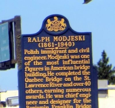
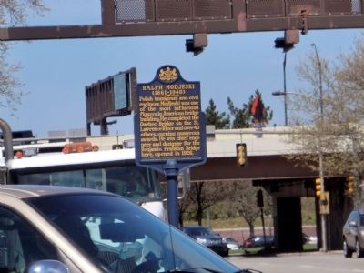
William Penn Annex East in Philadelphia in Philadelphia County, Pennsylvania — The American Northeast (Mid-Atlantic)
Ralph Modjeski
(1861-1940)
Erected 2007 by Pennsylvania Historical & Museum Commission.
Topics and series. This historical marker is listed in this topic list: Bridges & Viaducts. In addition, it is included in the Pennsylvania Historical and Museum Commission series list. A significant historical year for this entry is 1926.
Location. 39° 57.294′ N, 75° 8.972′ W. Marker is in Philadelphia, Pennsylvania, in Philadelphia County. It is in William Penn Annex East. Marker is at the intersection of North 6th Street and Race Street on North 6th Street. The marker is located on the North West corner, at Franklin Square Park entrance. Touch for map. Marker is at or near this postal address: 221 N Independence Mall W, Philadelphia PA 19106, United States of America. Touch for directions.
Other nearby markers. At least 8 other markers are within walking distance of this marker. Francis Hopkinson (Philadelphia Home) (a few steps from this marker); Franklin Square (within shouting distance of this marker); History of Franklin Square (within shouting distance of this marker); Benjamin Franklin Bridge (within shouting distance of this marker); Pennsylvania Hall (about 300 feet away, measured in a direct line); a different marker also named Franklin Square (about 300 feet away); Historic Burial Grounds (about 300 feet away); History of the Fountain (about 300 feet away). Touch for a list and map of all markers in Philadelphia.
Credits. This page was last revised on February 2, 2023. It was originally submitted on May 2, 2015, by Don Morfe of Baltimore, Maryland. This page has been viewed 482 times since then and 35 times this year. Photos: 1, 2. submitted on May 2, 2015, by Don Morfe of Baltimore, Maryland. • Bill Pfingsten was the editor who published this page.

