Foggy Bottom in Northwest Washington in Washington, District of Columbia — The American Northeast (Mid-Atlantic)
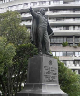
Benito Juárez Memorial
— Statues of the Liberators —
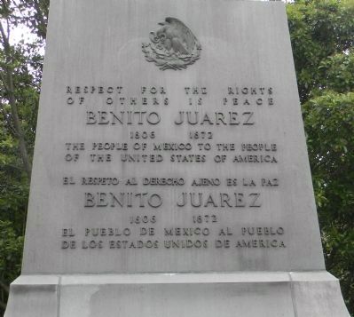
[Inscriptions, east face:]
of others is peace
Benito Juárez
1806-1872
The people of Mexico to the people
of the United States of America
El respeto al derecho ajeno es la paz
Benito Juárez
1806-1872
El pueblo de Mexico al pueblo
de los Estados Unidos de America
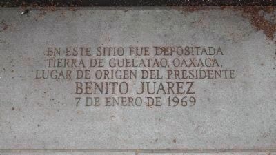
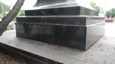
[Inscription, center of west base:]
tierra de Guelatao, Oaxaca,
lugar de origen del Presidente
BENITO JUAREZ
7 de Enero de 1969
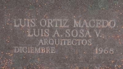
[Inscription, lower right corner of west pedestal:]
Luis A. Sosa V[illasenor]
Arquitectos
Diciembre 1968
Erected 1968 by Government of Mexico.
Topics. This historical marker and memorial is listed in these topic lists: Government & Politics • Native Americans • Wars, Non-US. A significant historical year for this entry is 1969.
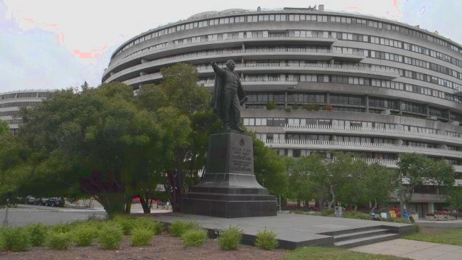
Location. 38° 53.927′ N, 77° 3.217′ W. Marker is in Northwest Washington in Washington, District of Columbia. It is in Foggy Bottom. Marker is at the intersection of Virginia Avenue Northwest and 25th Street Northwest, on the right when traveling east on Virginia Avenue Northwest. The Memorial is across 25th Street Northwest from the Watergate Complex, in the park constructed above the I-66 Freeway and within the traffic circle that also includes New Hampshire Avenue, Northwest. Touch for map. Marker is in this post office area: Washington DC 20037, United States of America. Touch for directions.
Other nearby markers. At least 8 other markers are within walking distance of this marker. The Watergate Hotel (about 500 feet away, measured in a direct line); The American Meridian (about 700 feet away); Philip S. Amsterdam Hall (about 800 feet away); Site of 2310 H Street, Northwest (approx. 0.2 miles away); St. Mary’s Episcopal Church (approx. 0.2 miles away); Saint Mary's Episcopal Church (approx. 0.2 miles away); Carol Brown Goldberg (approx. 0.2 miles away); A Canal to the West (approx. 0.2 miles away). Touch for a list and map of all markers in Northwest Washington.
Also see . . .
1. Benito Juárez. (Submitted on June 5, 2013, by Richard E. Miller of Oxon Hill, Maryland.)
2. Statues of the Liberators. (Submitted on June 5, 2013, by Richard E. Miller of Oxon Hill, Maryland.)
Additional keywords. Enrique Alciati, sculptor; "Pablo Benito Juárez Monument and Park"; "Builder of Modern Mexico"; Luis Sosa Villasenor; National Park Service; Statues of the Liberators.
Credits. This page was last revised on January 30, 2023. It was originally submitted on June 5, 2013, by Richard E. Miller of Oxon Hill, Maryland. This page has been viewed 725 times since then and 12 times this year. Last updated on May 4, 2015, by J. Makali Bruton of Accra, Ghana. Photos: 1, 2, 3, 4, 5, 6. submitted on June 5, 2013, by Richard E. Miller of Oxon Hill, Maryland. • Bill Pfingsten was the editor who published this page.
