Waverly in Humphreys County, Tennessee — The American South (East South Central)
Fort Hill at Waverly
Defending Railroads
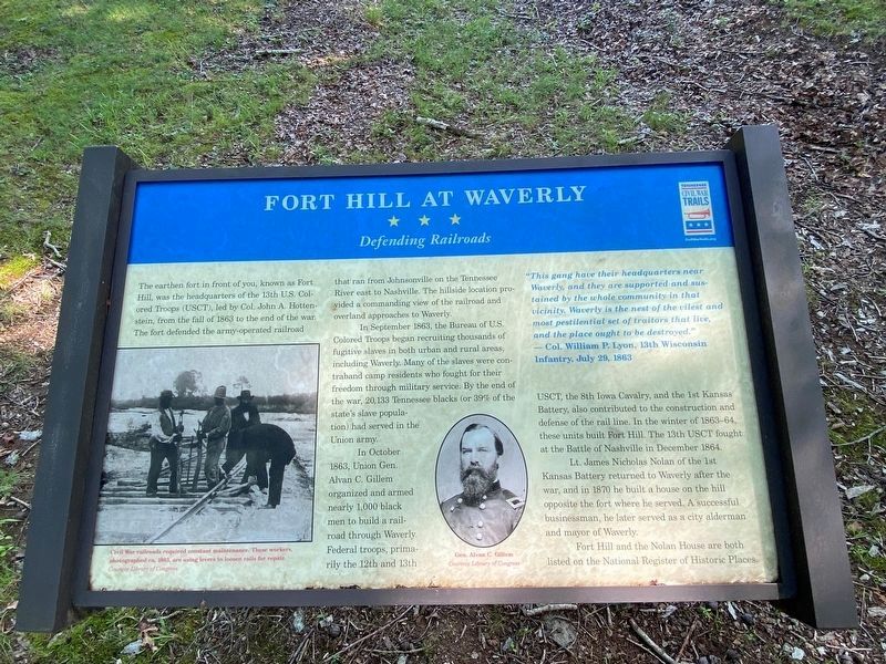
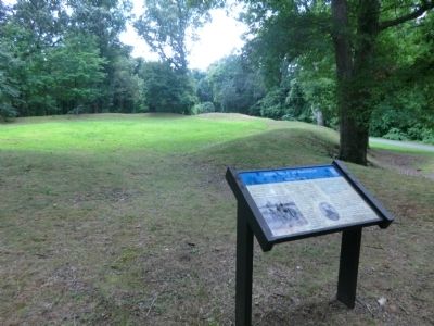
The earthen fort in front of you, known as Fort Hill, was the headquarters of the 13th U.S. Colored Troops (USCT), led by Col. John A. Hottenstein, from the fall of 1863 to the end of the war. The fort defended the army-operated railroad that ran from Johnsonville on the Tennessee River east to Nashville. The hillside location provided a commanding view of the railroad and overland approaches to Waverly.
In September 1863, the Bureau of U.S. Colored Troops began recruiting thousands of fugitive slaves in both urban and rural areas, including Waverly. Many of the slaves were contraband camp residents who fought for their freedom through military service. By the end of the war, 20,000 Tennessee blacks had served in the Union army.
In October 1863, Union Gen. Alvan C. Gillem organized and armed nearly 1,000 black men to build a railroad through Waverly. Federal troops, primarily the 12th and 13th USCT, the 8th Iowa Cavalry and the 1st Kansas Battery also contributed to the construction and defense of the rail line. In the winter of 1863-64, these units built Fort Hill. The 13th USCT fought at the Battle of Nashville in December 1864.
Lt. James Nicholas Nolan of the 1st Kansas Battery returned to Waverly after the war, and in 1870 he built a house on the hill opposite the fort where he served. A successful businessmen, he later served as a city alderman and mayor of Waverly.
Fort Hill and the Nolan House are both listed on the National Register of Historic Places.
"This gang have their headquarters near Waverly, and they are supported and sustained by the whole community in that vicinity. Waverly is the nest of the vilest and most pestilential set of traitors that live, and the place ought to be destroyed." — Col. William P. Lyon, 13th Wisconsin Infantry, July 29, 1863
[Caption:]
Civil War railroads required constant maintenance. These workers, photographed ca. 1863, are using levers to loosen rails for repair.
Erected by Tennessee Civil War Trails.
Topics and series. This historical marker is listed in these topic lists: African Americans • Forts and Castles • Railroads & Streetcars • War, US Civil. In addition, it is included in the Tennessee Civil War Trails series list. A significant historical date for this entry is July 29, 1888.
Location. 36° 4.867′ N, 87° 47.517′ W. Marker is in Waverly, Tennessee, in Humphreys County. Marker can be reached from Fort Hill Road, 0.2 miles South Church Street (Tennessee Route 13), on the right when traveling east. Touch for map. Marker is at or near this postal address: 201 Fort Hill Rd, Waverly TN 37185, United States of America. Touch for directions.
Other nearby markers. At least 8 other markers are within walking distance of this marker. Fort Waverly (a few steps from this marker); Welcome to Fort Waverly & The Humphreys County and Civil War Museum (within shouting distance of this marker); The Butterfield House (within shouting distance of this marker); Fort Hill (about 800 feet away, measured in a direct line); Reynoldsburg (approx. 0.2 miles away); Humphreys County War Memorial (approx. 0.2 miles away); Battle of Johnsonville (approx. 0.2 miles away); Humphreys County (approx. 0.2 miles away). Touch for a list and map of all markers in Waverly.
Credits. This page was last revised on July 16, 2021. It was originally submitted on September 30, 2013, by Don Morfe of Baltimore, Maryland. This page has been viewed 1,201 times since then and 62 times this year. Last updated on May 5, 2015, by Byron Hooks of Sandy Springs, Georgia. Photos: 1. submitted on July 15, 2021, by Darren Jefferson Clay of Duluth, Georgia. 2. submitted on September 30, 2013, by Don Morfe of Baltimore, Maryland. • Andrew Ruppenstein was the editor who published this page.

