Near Washtucna in Franklin County, Washington — The American West (Northwest)
In the Path of Cataclysmic Floods
Massive Glacial Dams and Lakes
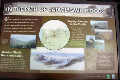
During the last Ice Age, a lobe of ice at least a half-mile high blocked the Clark Fork River in Idaho, creating an enormous lake called Glacial Lake Missoula. This ice dam failed - over and over - sending billions of tons of water rampaging across the land.
Raging Journey to the Pacific
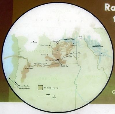
The thundering torrent of water, icebergs, and mud raced at speeds up to 60 mph, stripping away tons of soil and rock. The floodwaters raged across eastern Washington, through the Columbia River Gorge, and to the ocean.
How Many Floods Were There?
No one knows for sure, but geologists discovered evidence the Lake Missoula and other glacial lakes filled and emptied many times during the last Ice Age.
(Left Illustration Caption)
At times, the ice dams was more than two miles wide and 30 miles long.
(Center Illustration Caption)
Pressure from rising water caused the ice dam to leak and crack. Over time, water began pouring from large fractures beneath the surface, eroding the dam from below until it suddenly failed.
(Upper Right Photo Caption)
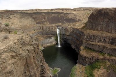
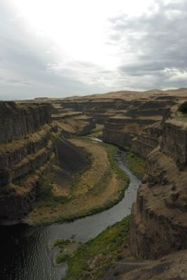
You can visit many of the remarkable features created by the Ice Age floods, including Dry Falls, Steamboat Rock, and Beacon Rock.
Erected by Washington State Parks.
Topics. This historical marker is listed in this topic list: Natural Features.
Location. 46° 39.823′ N, 118° 13.628′ W. Marker is near Washtucna, Washington, in Franklin County. Marker can be reached from Palouse Falls Road, 2.4 miles west of Washington Highway 261. Marker is located in Palouse Falls State Park at the end of Palouse Falls Road; a entrance fee may be required. Touch for map. Marker is in this post office area: Washtucna WA 99371, United States of America. Touch for directions.
Other nearby markers. At least 6 other markers are within 5 miles of this marker, measured as the crow flies. Explore Massive Floodscapes! (here, next to this marker); Stealing a Stream (within shouting distance of this marker); Setting the Stage (about 300 feet away, measured in a direct line); Overwhelming Proof for an "Outrageous" Theory (about 300 feet away); Small Town, Big Voice (about 300 feet away); M - R Military Road (approx. 4.7 miles away).
More about this marker. There is an identical interpretive sign located in Ginkgo Petrified Forest State Park in Kittitas County, Washington.
Also see . . . Palouse Falls - Wikipedia entry. This article also has links to Wikipedia entries on the Columbia River Basalt Group, the Channeled Scablands, and the Missoula Floods. (Submitted on May 6, 2015.)
Credits. This page was last revised on June 16, 2016. It was originally submitted on May 6, 2015, by Duane Hall of Abilene, Texas. This page has been viewed 364 times since then and 8 times this year. Photos: 1, 2, 3, 4. submitted on May 6, 2015, by Duane Hall of Abilene, Texas.
Editor’s want-list for this marker. Photo of wide-view of marker and surrounding area. • Can you help?


