White Plains in Westchester County, New York — The American Northeast (Mid-Atlantic)
Battle of White Plains
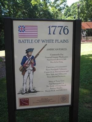
American Forces
— 1776 —
General George Washington
Numbered about 14,500
Men fit for Duty,
Consisting of Continentals
From Maryland, Delaware,
Connecticut, Pennsylvania and
New York, and Militiamen
From Several Provinces.
Many of These Units
Had Participated in
The Battle of Long Island,
Harlem Heights,
Throg’s Neck, and Pell’s Point.
Erected by the City of White Plains to commemorate the 225th Anniversary of the Battle
Back of Marker:
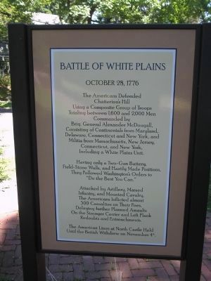
Battle of White Plains
October 28, 1776
The Americans Defended
Chatterton’s Hill
Using a Composite Group of Troops
Totalling between 1,600 and 2,000 Men
Commanded by
Brig. General Alexander McDougall,
Consisting of Continentals from Maryland,
Delaware, Conneecticut and New York, and
Militia from Massachusetts, New Jersey,
Connecticut, and New York,
Including a White Plains Unit.
Having only a Two-Gun Battery,
Field-Stone Walls, and Hastily Made Positions,
They Followed Washington’s Orders to
"Do the Best You Can."
Attacked by Artillery, Massed
Infantry, and Mounted Cavalry,
The Americans Inflicted almost
300 Casualties on Their Foes,
Delaying further Planned Assaults
On the Stronger Center and Left Flank
Redoubts and Entrenchments.
The American Lines at North Castle Held
Until the British Withdrew on November 4th.
Erected 2001 by City of White Plains.
Topics. This historical marker is listed in these topic lists: Military • Notable Events • Notable Places • War, US Revolutionary. A significant historical month for this entry is October 1889.
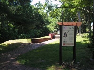
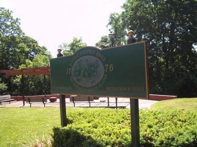
Location. 41° 1.822′ N, 73° 46.772′ W. Marker is in White Plains, New York, in Westchester County. Marker is on Battle Avenue, on the right when traveling east. Marker is located in Battle Whitney Park. Touch for map. Marker is in this post office area: White Plains NY 10606, United States of America. Touch for directions.
Other nearby markers. At least 8 other markers are within walking distance of this marker. A different marker also named Battle of White Plains (within shouting distance of this marker); a different marker also named Battle of White Plains (within shouting distance of this marker); Battle Park (within shouting distance of this marker); a different marker also named Battle of White Plains (within shouting distance of this marker); a different marker also named Battle of White Plains (about 300 feet away, measured in a direct line); Washington Arms Apartments (about 500 feet away); a different marker also named The Battle of White Plains (approx. 0.2 miles away); Jacob Purdy House (approx. 0.6 miles away). Touch for a list and map of all markers in White Plains.
More about this marker. The left side of the marker features a "Grand Union" or "Cambridge Flag." flag and a Continental infantryman.
The lower right of the marker features the seal of the City of White Plains. The motto “Liberty or Death” appears on the lower left of the marker.
Regarding Battle of White Plains. Take a Virtual Tour by Markers of the Battle of White Plains, NY.
Related markers. Click here for a list of markers that are related to this marker. To better understand the Battle of White Plains, NY, study each marker in the order shown.
Also see . . .
1. The Battle of White Plains. The American Revolutionary War website entry (Submitted on June 12, 2008, by Bill Coughlin of Woodland Park, New Jersey.)
2. Battle of White Plains. Wikipedia entry (Submitted on March 4, 2021, by Larry Gertner of New York, New York.)
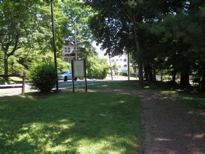
Photographed By Bill Coughlin, June 11, 2008
3. Marker on Battle Avenue
Washington did not believe this site on Chatterson's Hill to be important enough to occupy. British Gen. William Howe, however, immediately recognized the potential of this high ground and made it the objective of his initial attacks.
Credits. This page was last revised on May 16, 2022. It was originally submitted on June 12, 2008, by Bill Coughlin of Woodland Park, New Jersey. This page has been viewed 1,843 times since then and 36 times this year. Photos: 1, 2, 3, 4, 5. submitted on June 12, 2008, by Bill Coughlin of Woodland Park, New Jersey.
