Near Forest Home in Butler County, Alabama — The American South (East South Central)
The Butler Massacre / Fort Bibb
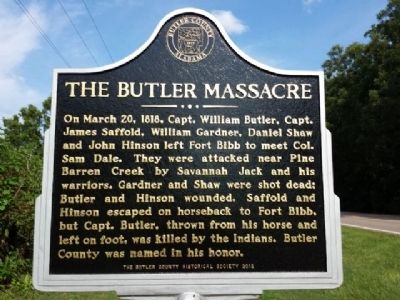
On March 20, 1818, Capt. William Butler, Capt. James Saffold, William Gardener, Daniel Shaw and John Hinson left Fort Bibb to meet Col. Sam Dale. They were attacked near Pine Barren Creek by Savannah Jack and his warriors. Gardener and Shaw were shot dead; Butler and Hinson wounded. Saffold and Hinson escaped on horseback to Fort Bibb, but Capt. Butler, thrown from his horse and left on foot, was killed by the Indians. Butler County was named in his honor.
(reverse)
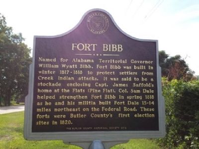
Named for Alabama Territorial Governor William Wyatt Bibb, Fort Bibb was built in winter 1817-1818 to protect settlers from Creek Indian attacks. It was said to be a stockade enclosing Capt. James Saffold's home at the Flats (Pine Flats). Col. Sam Dale helped strengthen Fort Bibb in spring 1818 as he and his militia built Fort Dale 13-14 miles northeast on the Federal Road. These forts were Butler County's first election sites in 1820.
Erected 2012 by Butler County Historical Society.
Topics. This historical marker is listed in these topic lists: Forts and Castles • Native Americans • Wars, US Indian. A significant historical month for this entry is March 1871.
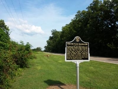
Location. 31° 50.308′ N, 86° 52.949′ W. Marker is near Forest Home, Alabama, in Butler County. Marker is on Pineapple Highway (Alabama Route 10) 0.8 miles west of Bibb Road (County Road 5), on the right when traveling west. Touch for map. Marker is in this post office area: Forest Home AL 36030, United States of America. Touch for directions.
Other nearby markers. At least 8 other markers are within 13 miles of this marker, measured as the crow flies. Old Federal Road (approx. 6.2 miles away); Pine Apple Historic District (approx. 6.3 miles away); Moore Academy (approx. 6.6 miles away); Downtown Pine Apple (approx. 6.7 miles away); a different marker also named Pine Apple Historic District (approx. 7.1 miles away); Coleman-Crenshaw House (approx. 8.1 miles away); Ogly-Stroud Massacre / Gary's Stockade (approx. 10.6 miles away); Furman National Historic District (approx. 12.1 miles away).
More about this marker. This is a replacement marker. Previously these were two separate markers in different locations, one for the Butler Massacre & one for Fort Bibb. Both went missing in 2010. The original Butler Massacre marker was stolen on May 8th, 2011 and later found in pieces at a local recycling center. The thieves received $22.00 for the @ $2,000 marker.
The Butler Massacre marker, erected in 1953, read:
Butler Massacre
March 20, 1818
Creek Indians, led by Savannah Jack, attacked a well-armed party of settlers carrying dispatches to Fort Dale.
After this second massacre in 7 days settlers sought refuge in forts and stockades.
The Site of Fort Bibb marker, erected in 1953, read:
Site of
Fort Bibb
Built in 1818 by settlers as refuge from marauding Creek Indians who resented loss of land by Treaty of Fort Jackson in 1814.
Also see . . . The Massacres. by Peter A. Brannon, Montgomery Advertiser Newspaper, 01/31/1943 (Submitted on August 28, 2013, by Mark Hilton of Montgomery, Alabama.)
Credits. This page was last revised on January 28, 2019. It was originally submitted on August 28, 2013, by Mark Hilton of Montgomery, Alabama. This page has been viewed 4,593 times since then and 241 times this year. Last updated on May 15, 2015, by J. Makali Bruton of Accra, Ghana. Photos: 1, 2, 3. submitted on August 28, 2013, by Mark Hilton of Montgomery, Alabama. • Bill Pfingsten was the editor who published this page.


