Near Berlin in Worcester County, Maryland — The American Northeast (Mid-Atlantic)
Native Americans
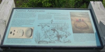
Little is known about the life of these early people. Local tribes such as the Pocomoke, Nanticoke, Gingoteague, and Assateague were loosely part of the Algonquin-speaking Indian family, but each had its own unique culture.
Life Along the Coast
Though not much is known about the customs, dwellings, or even dress of the different Indian groups, many scientists think they had a "good" life - abundant food, few diseases, and enough natural resources to meet their needs. Shellfish were preserved by smoking and plant foods were dried.
Deer and bear provided skins for clothing. Even the clamshell was useful. The inner purple coloring was used as barter.
It is probably that life along these shores remained relatively unchanged for almost 12,000 years. Within 200 years of European contact, most Indians had left the area.
Some local Indians, including the Assateague tribe, had an unusual burial custom. They removed the skin from the body after death and scraped the bones free of flesh. Remains were then placed on shelves in a log structure. Periodically, the remains were collected and buried in a common grave or ossuary. Several ossuaries have been discovered on the Eastern Shore. The photo above shows a burial site in North Carolina, which was relocated to save it from coastal erosion.
Topics. This historical marker is listed in this topic list: Native Americans.
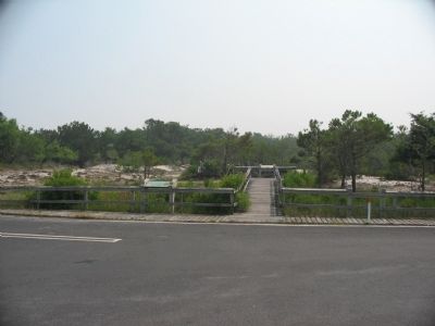
Location. 38° 11.909′ N, 75° 9.364′ W. Marker is near Berlin, Maryland, in Worcester County. Marker is at the intersection of Ferry Landing Road and Bayberry Drive, on the right when traveling west on Ferry Landing Road. Located in a parking area across from the intersection, off Bayberry Drive. The markers are in Assateague Island National Seashore. Touch for map. Marker is in this post office area: Berlin MD 21811, United States of America. Touch for directions.
Other nearby markers. At least 8 other markers are within 3 miles of this marker, measured as the crow flies. Saving Lives (within shouting distance of this marker); Olde Sinepuxent (approx. 0.4 miles away); Keep Them Safe / Keep Them Wild (approx. half a mile away); a different marker also named Keep Them Safe / Keep Them Wild (approx. 0.6 miles away); Baltimore Boulevard (approx. 0.7 miles away); Wild and Free (approx. 2.8 miles away); Peregrine Falcon Migration (approx. 2.8 miles away); Swindler Park (approx. 3 miles away). Touch for a list and map of all markers in Berlin.
More about this marker. In the center is a depiction of a Native American hunting waterfowl, having gathered a collection of oysters. In the lower left is a photograph of some artifacts, captioned: Projectile points (arrowheads), net weights, and grinding stones are occasionally found on Assateague, but only in the surf zone. Why? Since the island is steadily moving westward, the ancient forest and bay used by Native Americans are now out to sea. Artifacts wash in from off-shore sites. On the right is a photograph of an ossuary in North Carolina.
Also see . . . Assateague Island National Seashore. National Park Service site. (Submitted on June 15, 2008, by Craig Swain of Leesburg, Virginia.)
Credits. This page was last revised on June 16, 2016. It was originally submitted on June 15, 2008, by Craig Swain of Leesburg, Virginia. This page has been viewed 2,563 times since then and 102 times this year. Photos: 1, 2. submitted on June 15, 2008, by Craig Swain of Leesburg, Virginia.

