Near Berlin in Worcester County, Maryland — The American Northeast (Mid-Atlantic)
Treasures from the Past
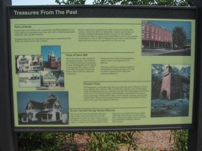
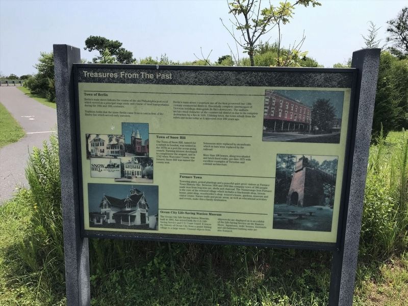
Town of Berlin
Berlin's main street follows the course of the old Philadelphia post road which served as a principal stage route and course of land transportation during the 18th and 19th centuries.
Tradition holds that the name Berlin came from a contraction of the Burley Inn which served early travelers.
Berlin's main street comprises one of the best preserved late 19th century commercial districts. Essentially complete streetscapes of Victorian buildings distinguish Berlin's downtown. The uniform architectural character of the commercial district is due to its complete destruction by a fire in 1895. Utilizing brick, the town was rebuilt from the ashes and looks today as it appeared over 100 years ago.
Town of Snow Hill
The Town of Snow Hill, named for a suburb in London, was settled in the 1670s as a port for ocean-going vessels. Farming interest developed to complement the seaport, and in 1742 when Worcester County was formed, Snow Hill was named the county seat.
Schooners were replaced by steamboats which in turn were replaced by the railroad.
More than 100 homes, along tree-shaded and brick-lined walks, pre-date 1875 with excellent examples of Victorian and colonial architecture.
Furnace Town
Towering pines, period plantings and a peaceful quite greet visitors at Furnace Town Historic Site. Between 1830 and 1850 this company town of 300 people made iron from bog iron ore, shells and charcoal. The Nassawango Iron Furnace is the core or the restored village which includes a blacksmith shop, broom house, print shop, woodworker's shop, weaver's house, gardens, museum and visitor center. Nature trails and picnic areas, as well as educational activities and events, make this a family destination.
Ocean City Life-Saving Station Museum
The Ocean City Life-Saving Station Museum, built in 1891 has served both the U.S. Life-Saving Service and U.S. Coast Guard. It traces the history of Ocean City from a quaint fishing village to a large resort. Unusual objects from shipwrecks are displayed as is an exhibit of the Life-Saving Service on the Eastern Shore. Aquariums, dolls' houses, mermaids, and old-fashioned bathing suits are also featured.
Topics. This historical marker is listed in this topic list: Industry & Commerce. A significant historical year for this entry is 1895.
Location. 38° 14.973′ N, 75° 9.357′ W. Marker is near Berlin, Maryland, in Worcester County. Marker is at the intersection of National Seashore Lane and Stephen Decatur Highway (State Highway 611), on the right when traveling north on National Seashore Lane. Marker is located next to the visitors center for the Assateague Island National Seashore. Touch for map. Marker is at or near this postal address: 7206 National Seashore Lane, Berlin MD 21811, United States of America. Touch for directions.
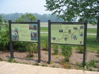
Other nearby markers. At least 8 other markers are within walking distance of this marker. Beach to Bay Indian Trail (here, next to this marker); The Wild Ponies (a few steps from this marker); Caring for the Bay (approx. 0.2 miles away); Sheltered Waters (approx. 0.2 miles away); You're looking out over… A Productive Nursery (approx. 0.2 miles away); Berlin / Snow Hill / Wallops Flight Facility / Chincoteague (approx. 0.2 miles away); Verrazano Bridge (approx. ¼ mile away); Stephen Tyng Mather (approx. ¼ mile away). Touch for a list and map of all markers in Berlin.
More about this marker. The marker features photographs of Berlin's commercial district, Snow Hill's houses, the iron furnace of Furnace Town, and The Life-Saving Station Museum.
Also see . . .
1. Assateague Island National Seashore. National Park Service site. (Submitted on June 15, 2008, by Craig Swain of Leesburg, Virginia.)
2. Explore the small coastal towns of Worcester County, MD (Maryland’s only seaside). The Washington Post website entry (2023) (Submitted on November 14, 2023, by Larry Gertner of New York, New York.)
3. Furnace Town Historic Site. Website homepage (Submitted on June 15, 2008, by Craig Swain of Leesburg, Virginia.)
Photographed By Craig Swain, June 14, 2008
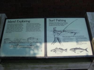
5. Island Exploring and Surf Fishing Informational Signs
Near the marker set are these informational signs:
Island Exploring
Do you think of Assateage Island as a summer beach? Assateague has a wilder side. Shifting dunes, pine forest, freshwater ponds, and tidal marshes support a rich abundance of wildlife. Take time to explore the Life of the Dunes, Life of the Forest, and Life of the Marsh nature trails as they wind through some of Assateague's hidden places.
Walk north from Assateague State Park for beachcombing in a secluded setting. Explore the bay side by canoe starting at Old Ferry Landing. Or visit the Virginia section of Assateague, where national seashore and wildlife refuge nature trails offer great birdwatching in all seasons.
Surf Fishing
Assateague Island offers some of the finest surf fishing on the Atlantic Coast. In season you may catch flounder, bluefish, spot, weakfish, and many other varieties.
Credits. This page was last revised on November 14, 2023. It was originally submitted on June 15, 2008, by Craig Swain of Leesburg, Virginia. This page has been viewed 1,725 times since then and 13 times this year. Photos: 1. submitted on June 15, 2008, by Craig Swain of Leesburg, Virginia. 2. submitted on January 15, 2022, by Adam Margolis of Mission Viejo, California. 3. submitted on June 15, 2008, by Craig Swain of Leesburg, Virginia. 4. submitted on September 6, 2015, by Shane Oliver of Richmond, Virginia. 5, 6. submitted on June 15, 2008, by Craig Swain of Leesburg, Virginia.
