Prescott in Leeds and Grenville United Counties, Ontario — Central Canada (North America)
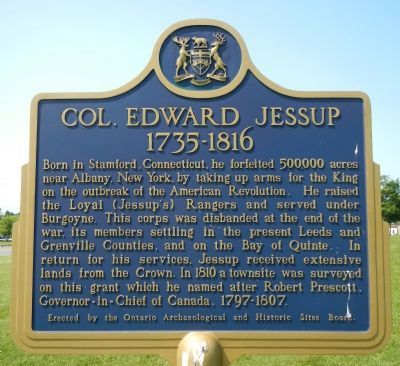
Col. Edward Jessup
1735-1816
Erected by Ontario Archaeological and Historical Sites Board.
Topics. This historical marker is listed in these topic lists: Settlements & Settlers • War, US Revolutionary. A significant historical year for this entry is 1810.
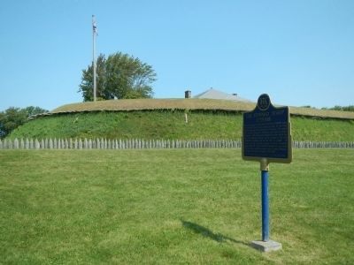
Location. 44° 42.728′ N, 75° 30.543′ W. Marker is in Prescott, Ontario, in Leeds and Grenville United Counties. Marker is on King Street East (County Route 2) close to Vankoughnet Street, on the left. Touch for map. Marker is at or near this postal address: 310 King Street East, Prescott ON K0E, Canada. Touch for directions.
Other nearby markers. At least 8 other markers are within walking distance of this marker. Prescott War Memorial (about 90 meters away, measured in a direct line); Bytown and Prescott Railway Company 1850 (about 90 meters away); Fort Wellington (about 150 meters away); Major James Morrow Walsh 1840-1905 (about 240 meters away); Fort Wellington Hospital (approx. 0.2 kilometers away); Prescott Barracks and Hospital (approx. 0.3 kilometers away); Lighthouse Restoration Project (approx. 0.3 kilometers away); Lieutenant William Frederick Nelson Sharpe (approx. 0.4 kilometers away). Touch for a list and map of all markers in Prescott.
Also see . . . Edward Jessup - Dictionary of Canadian Biography. With the war lost, Jessup began in the summer of 1783 to plan the resettlement of his corps and was one of those who proposed the Ottawa River and the upper St Lawrence for that purpose. Although his proposal for structured settlements based on military rank was rejected, Haldimand incorporated a number of his other ideas into the plan finally adopted. In that plan Jessup’s Rangers were allotted townships No.6 (Edwardsburg), No.7 (Augusta), and part of No.8 (Elizabethtown), all on the St Lawrence, as well as No.2 (Ernestown), west of Cataraqui (Kingston). (Submitted on May 19, 2015, by Barry Swackhamer of Brentwood, California.)
Credits. This page was last revised on September 27, 2019. It was originally submitted on May 19, 2015, by Barry Swackhamer of Brentwood, California. This page has been viewed 453 times since then and 20 times this year. Photos: 1, 2. submitted on May 19, 2015, by Barry Swackhamer of Brentwood, California. • Andrew Ruppenstein was the editor who published this page.

