Coteau-du-Lac in Vaudreuil-Soulanges, Québec — Central Canada (French-Canadian)
Destination: Great Lakes / Destination: Les Grands Lacs
Coteau-du-Lac: Supply Post / Coteau-du-Lac: Centre de ravitaillement
Inscription.
English:
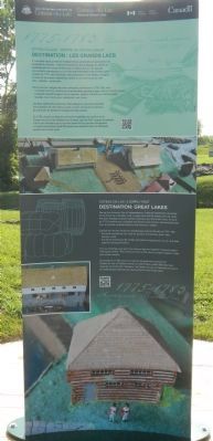
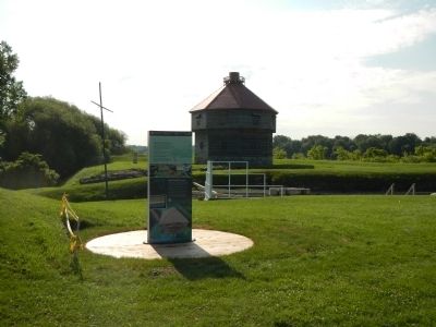
During the American War of Independence, Frederick Haldimand, Governor of the Province of Quebec, had a supply post built at Coteau-du-Lac, given the site’s strategic location between Montreal and the Great Lakes. As early as 1779, blockhouse, palisades and abatis protected the canal and the post from a possible surprise attack by the American “rebels.”
Explore the remains of the two storehouses built on the site in 1779-1780: — the North storehouse (A), used for general merchandise (pork, flour, biscuits, nails):
— the South storehouse (B), initially intended for liquids such as rum, but soon used for storing provisions.
The two buildings were each two storeys high and together measured about 160 square metres. They were built next to the canal, to make it easier to load and unload vessels.
According to a 1780 record of supplies shipped from Lachine and Coteau-du-Lac to Carleton Island on Lake Ontario, nearly 900 trips were made by flat-bottomed “batteaux” via Coteau-du-Lac to transport provisions for 6,000 people stationed at various posts on the Great Lakes.
French:
À l’occasion de la guerre de l’indépendance américaine, le gouverneur de la colonie du Québec, Frederick Haldimand, fait aménager un centre de ravitaillement de l’armée britannique à Coteau-du-Lac, qui occupe une position avantageuse sur la route entre Montréal et les Grands Lacs. À partier de 1779, des blockhaus, des palissades et des abattis protègent le canal et les autres installations contre un éventuel coup de main des «rebelles» américains.
Découvrez les vestiges des deux entrepôts construits en 1779-1780, soit:
— l’entrepôt Nord (A),destiné aux marchandises générales (porc, farine, biscuits, clous):
— l’entrepôt (B), (magasin de la caserne), destiné d’abord aux marchandises liquides, tel le rhum, puis, rapidement aux vivres.
Les deux bâtiments comportent deux étages et couvrent ensemble un superficie de 160 mètres carrés. Ils sont construits en bordure du canal afin de faciliter le chargement des bateaux.
En 1760, d’après un état de provisions expédiées de Lachine et du Coteau-du-Lac à l’île Carleton (lac Ontario), Apres de 900 voyages de bateaux a fond plat transitant par ici avaient acheminé les denrées nécessaires à l’approvisionnement de 6 000 personnes réparties dans les différents postes des Grands Lacs.
Topics. This historical marker is listed in these topic lists: Forts and Castles • War of 1812 • Waterways & Vessels. A significant historical year for this entry is 1779.
Location. 45° 17.271′ N, 74° 10.559′
W. Marker is in Coteau-du-Lac, Québec, in Vaudreuil-Soulanges. Marker is on Chemin du Fleuve close to Rue du Fort, on the left when traveling south. Touch for map. Marker is at or near this postal address: 307 Chemin du Fleuve, Coteau-du-Lac QC J0P 1B0, Canada. Touch for directions.
Other nearby markers. At least 8 other markers are within walking distance of this marker. A very busy canal (a few steps from this marker); Adapting the canal to new needs (a few steps from this marker); North blockhouse / Le blockhaus nord (a few steps from this marker); A canal that must be preserved (a few steps from this marker); The Durham boat (within shouting distance of this marker); What is a lock canal? (within shouting distance of this marker); A dry canal (within shouting distance of this marker); A canal excavated in the rock (within shouting distance of this marker). Touch for a list and map of all markers in Coteau-du-Lac.
More about this marker. This marker is located at Coteau-du-Lac National Historic Site.
Credits. This page was last revised on June 16, 2016. It was originally submitted on May 27, 2015, by Barry Swackhamer of Brentwood, California. This page has been viewed 293 times since then and 11 times this year. Photos: 1, 2. submitted on May 27, 2015, by Barry Swackhamer of Brentwood, California. • Andrew Ruppenstein was the editor who published this page.

