Cato in Cayuga County, New York — The American Northeast (Mid-Atlantic)
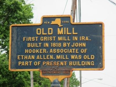
Old Mill
Built in 1818 by John
Hooker, associate of
Ethan Allen. Mill was old
part of present building.
Erected 1935 by New York State Education Department.
Topics. This historical marker is listed in this topic list: Settlements & Settlers. A significant historical year for this entry is 1818.
Location. 43° 10.077′ N, 76° 34.559′ W. Marker is in Cato, New York, in Cayuga County. Marker is on West Main Street (New York State Route 370) 0.2 miles west of North Street (New York State Route 34), on the right when traveling west. Marker is in the village of Cato, Town of Ira. The street is the town line. Touch for map. Marker is at or near this postal address: 2437 West Main Street, Cato NY 13033, United States of America. Touch for directions.
Other nearby markers. At least 8 other markers are within 9 miles of this marker, measured as the crow flies. Jakway's Corners (approx. 0.2 miles away); Site Where Four Towns Meet (approx. 0.9 miles away); Burial Place (approx. 1.1 miles away); In Memory of Abner Hollister (approx. 2 miles away); Cato Four Corners (approx. 2 miles away); Cobblestone (approx. 4˝ miles away); Patriot Burial (approx. 7.9 miles away); Jordan Lock 51 (approx. 8.1 miles away). Touch for a list and map of all markers in Cato.

Photographed By Anton Schwarzmueller, May 16, 2015
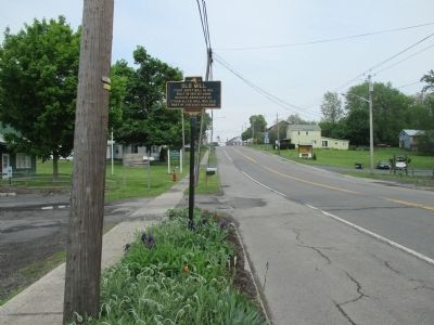
2. Westward
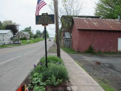
Apparently the decrepit taller building behind the red structure is the present building referred to on the marker. I did not recognize it as being part of a mill at the time, especially because the marker is at a parking area, not at the mill. See the building easily on Google street view.
Credits. This page was last revised on June 16, 2016. It was originally submitted on May 27, 2015, by Anton Schwarzmueller of Wilson, New York. This page has been viewed 460 times since then and 31 times this year. Photos: 1, 2, 3. submitted on May 27, 2015, by Anton Schwarzmueller of Wilson, New York.

