Cliftondale Park in Alleghany County, Virginia — The American South (Mid-Atlantic)
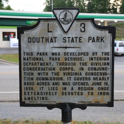
Douthat State Park
Erected 1939 by Virginia Conservation Commission. (Marker Number L-3.)
Topics and series. This historical marker is listed in these topic lists: Charity & Public Work • Parks & Recreational Areas. In addition, it is included in the Civilian Conservation Corps (CCC), and the Virginia Department of Historic Resources (DHR) series lists. A significant historical date for this entry is June 15, 1780.
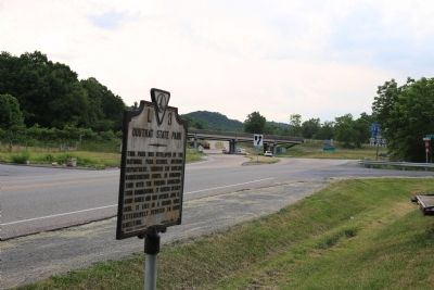
Location. 37° 49.517′ N, 79° 47.63′ W. Marker is in Cliftondale Park, Virginia, in Alleghany County. Marker is at the intersection of Grafton Street (Business U.S. 60) and Longdale Furnace Road (County Route 637), on the left when traveling west on Grafton Street. It is at Exit 27 on I-64, towards Clifton Forge, across from the gas station. Touch for map. Marker is in this post office area: Clifton Forge VA 24422, United States of America. Touch for directions.
Other nearby markers. At least 8 other markers are within 4 miles of this marker, measured as the crow flies. Robert Gallaspy Land Grant (approx. 1.8 miles away); Roger Arliner Young (approx. 1.8 miles away); Masonic Theatre (approx. 1.8 miles away); Alleghany County / Botetourt County (approx. 2.3 miles away); C&O Railroad Shops (approx. 2.6 miles away); Jackson River Depot (approx. 3.9 miles away); Oakland Presbyterian Church and Cemetery (approx. 4 miles away); Oakland Grove Presbyterian Church (approx. 4 miles away).
More about this marker. Before the Interstate was built, US 60 was the east-west highway. This marker was at the intersection with the road to the park, today’s Route 629.
Also see . . . Douthat State Park. The park is at 14239 Douthat State Park Rd., Millboro, VA 24460. “A traditional family park for 75 years, Douthat is listed on the National Register of Historic Places for the role its design played in the development of parks nationwide. Amid some of Virginia's most breathtaking mountain scenery, visitors enjoy interpretive programs, four miles of stream fishing, a 50-acre lake stocked with trout, a sandy swimming beach with snack bar, boat rentals, a gift shop and camp store, cabins, and more than 43 miles of hiking, mountain biking and bridle trails. Plus, there are playgrounds, an amphitheater, picnic areas, tent and trailer camping, and a restaurant overlooking the lake. The park also has 32 cabins and three lodges that accommodate 15, 16 and 18 guests each.” (Submitted on June 3, 2015.)
Credits. This page was last revised on July 3, 2021. It was originally submitted on June 3, 2015, by J. J. Prats of Powell, Ohio. This page has been viewed 504 times since then and 32 times this year. Photos: 1, 2. submitted on June 3, 2015, by J. J. Prats of Powell, Ohio.
Editor’s want-list for this marker. Photos of the park. • Can you help?

