Near Peterstown in Monroe County, West Virginia — The American South (Appalachia)
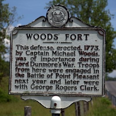
Woods’ Fort
Erected 1979 by West Virginia Department of Culture and History.
Topics and series. This historical marker is listed in these topic lists: Colonial Era • Forts and Castles • Wars, US Indian. In addition, it is included in the West Virginia Archives and History series list. A significant historical year for this entry is 1775.
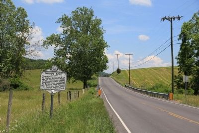
Location. 37° 25.103′ N, 80° 44.489′ W. Marker is near Peterstown, West Virginia, in Monroe County. Marker is on Koontz Road (U.S. 219) just north of Springwood Drive, on the right when traveling south. Touch for map. Marker is in this post office area: Peterstown WV 24963, United States of America. Touch for directions.
Other nearby markers. At least 8 other markers are within 7 miles of this marker, measured as the crow flies. Home of the Jones Diamond (approx. 3.4 miles away); Peterstown (approx. 3½ miles away); West Virginia (Monroe County) / Monroe County (approx. 3.6 miles away); Giles County / West Virginia (approx. 3.6 miles away in Virginia); Dr. Henry Lake Dickason (approx. 4.6 miles away); New River (approx. 5½ miles away in Virginia); First Court of Giles County (approx. 5.7 miles away in Virginia); Grave of Elizabeth Graham Stodghill (approx. 6.1 miles away). Touch for a list and map of all markers in Peterstown.
Credits. This page was last revised on June 9, 2020. It was originally submitted on June 4, 2015, by J. J. Prats of Powell, Ohio. This page has been viewed 784 times since then and 53 times this year. Photos: 1, 2. submitted on June 4, 2015, by J. J. Prats of Powell, Ohio.

