Belle Chasse in Plaquemines Parish, Louisiana — The American South (West South Central)
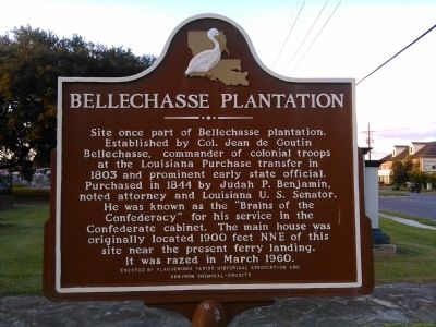
Bellechasse Plantation
Erected by Plaquemines Parish Historical Association and Chevron Chemical - Oronite.
Topics. This historical marker is listed in these topic lists: Government & Politics • Patriots & Patriotism • Settlements & Settlers • War, US Civil. A significant historical month for this entry is March 1960.
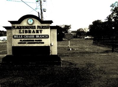
Location. 29° 51.156′ N, 89° 59.21′ W. Marker is in Belle Chasse, Louisiana, in Plaquemines Parish. Marker is at the intersection of Belle Chasse Highway (State Highway 23) and Avenue B, on the right when traveling south on Belle Chasse Highway. Located east of the Plaquemines Parish Library, just south of the Belle Chasse Auditorium. Touch for map. Marker is at or near this postal address: 8442 Highway 23, Belle Chasse LA 70037, United States of America. Touch for directions.
Other nearby markers. At least 8 other markers are within 5 miles of this marker, measured as the crow flies. English Turn (approx. 2.1 miles away); a different marker also named English Turn (approx. 2.2 miles away); Plaquemines Parish (approx. 2.4 miles away); Fort St. Leon (approx. 2.6 miles away); Jefferson Parish (approx. 3.2 miles away); Mary Plantation (approx. 3.4 miles away); a different marker also named Plaquemines Parish (approx. 4.3 miles away); Mel Ott (approx. 4.9 miles away). Touch for a list and map of all markers in Belle Chasse.
Credits. This page was last revised on March 18, 2017. It was originally submitted on June 5, 2015, by Lee Hattabaugh of Capshaw, Alabama. This page has been viewed 1,399 times since then and 161 times this year. Photos: 1, 2. submitted on June 5, 2015, by Lee Hattabaugh of Capshaw, Alabama. • Bernard Fisher was the editor who published this page.
Editor’s want-list for this marker. A better wide view photo of the marker and the surrounding area in context. • Can you help?

