Near New Castle in Craig County, Virginia — The American South (Mid-Atlantic)
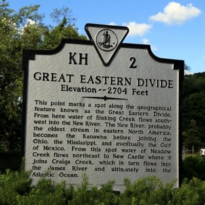
Great Eastern Divide
Elevation — 2704 Feet
Erected 1984 by Virginia Historic Landmark Commission. (Marker Number KH-2.)
Topics and series. This historical marker is listed in this topic list: Natural Features. In addition, it is included in the Virginia Department of Historic Resources (DHR) series list.
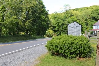
Location. 37° 26.632′ N, 80° 12.851′ W. Marker is near New Castle, Virginia, in Craig County. Marker is on Cumberland Gap Road (Virginia Route 42) 8.2 miles west of New Castle, on the left when traveling west. Touch for map. Marker is in this post office area: New Castle VA 24127, United States of America. Touch for directions.
Other nearby markers. At least 8 other markers are within 13 miles of this marker, measured as the crow flies. William Addison “Add” Caldwell (approx. 2˝ miles away); Roanoke County / Craig County (approx. 5.3 miles away); Audie Murphy Monument (approx. 5˝ miles away); New Castle (approx. 6.9 miles away); Catawba Sanatorium (approx. 7.4 miles away); Anderson-Doosing Farm (approx. 7.8 miles away); a different marker also named Great Eastern Divide (approx. 11˝ miles away in West Virginia); Roanoke College (approx. 12.2 miles away). Touch for a list and map of all markers in New Castle.
Related markers. Click here for a list of markers that are related to this marker.
Credits. This page was last revised on June 16, 2016. It was originally submitted on June 6, 2015, by J. J. Prats of Powell, Ohio. This page has been viewed 819 times since then and 71 times this year. Photos: 1, 2. submitted on June 6, 2015, by J. J. Prats of Powell, Ohio.

