Near Vail in Pima County, Arizona — The American Mountains (Southwest)
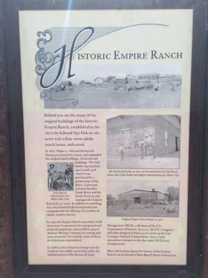
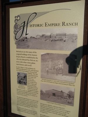
Historic Empire Ranch
Photographed By Wyndfire, April 2, 2011
1. Historic Empire Ranch Marker
Photo Captions:
Small inset on left:
John Harvey, Edward Vail, and Walter Vail, 1879.
Upper Right:
McFadden family fun, ca. 1900, at the north end of the Old Ranch House. Harry McFaddin was Empire Ranch foreman for Walter Vail.
Lower Right:
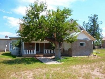
Original Empire Ranch House, ca. 1900
Small inset on left:
John Harvey, Edward Vail, and Walter Vail, 1879.
Upper Right:
McFadden family fun, ca. 1900, at the north end of the Old Ranch House. Harry McFaddin was Empire Ranch foreman for Walter Vail.
Lower Right:
Original Empire Ranch House, ca. 1900
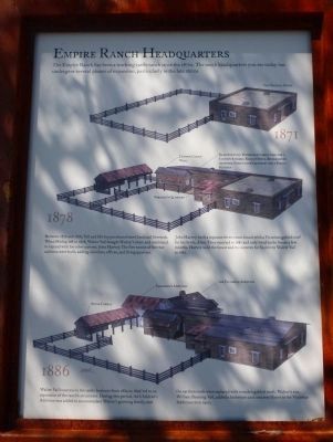
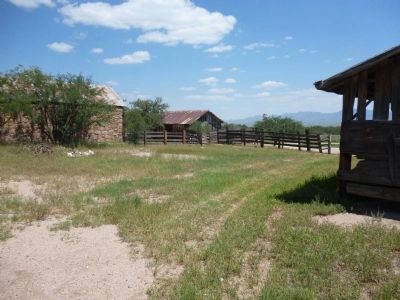
In 1876, Walter L. Vail and Herbert R. Hislop purchased the ranch and expanded the original land holdings, livestock and buildings. The Vail family operated the ranch until 1928 when it was purchased by a partnership of the Boice, Gates and Johnson families. Frank Boice and his family lived on and managed the Empire Ranch for 47 years. In addition to ranching, they also hosted Hollywood production companies for the filming of a number of classic western movies.
In 1969, the Empire Ranch was sold to Gulf American Corporation for a proposed real estate development, and resold in 1974 to Anamax Mining Company for mining and water potential. Fortunately, none of these developments materialized.
In 1988, a series of land exchanges put the property into public ownership under the administration of the Bureau of Land Management (BLM), a division of the U.S. Department of the Interior. In 2000, the U.S. Congress officially designated these 42,000 acres as the Las Cienegas National Conservation Area. Cattle operations continue to this day under BLM lease arrangements.
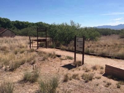
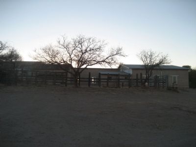
More information about the history of the Empire Ranch can be found in Main Ranch House behind you.
Erected by Bureau of Land Management (BLM).
Topics. This historical marker is listed in these topic lists: Agriculture • Industry & Commerce. A significant historical year for this entry is 1876.
Location. 31° 47.137′ N, 110° 38.508′ W. Marker is near Vail, Arizona, in Pima County. Marker can be reached from East Empire Ranch Road. Touch for map. Marker is in this post office area: Vail AZ 85641, United States of America. Touch for directions.
Other nearby markers. At least 5 other markers are within 10 miles of this marker, measured as the crow flies. Hired Man’s House – Who Lived Here?/Historic Preservation of the Hired Man’s House (within shouting distance of this marker); Home for Ranch Families (about 700 feet away, measured in a direct line); Sonoita Quarter Horse Show and Races (approx. 7.6 miles away); San Ignacia del Babocomari (approx. 8.3 miles away); Camp Crittenden (approx. 9.4 miles away).
Credits. This page was last revised on July 26, 2018. It was originally submitted on April 4, 2011, by Jennifer W. of Las Cruces, New Mexico. This page has been viewed 1,154 times since then and 16 times this year. Last updated on June 7, 2015, by J. Makali Bruton of Accra, Ghana. Photos: 1. submitted on April 5, 2011, by Jennifer W. of Las Cruces, New Mexico. 2, 3. submitted on June 7, 2015, by J. Makali Bruton of Accra, Ghana. 4, 5. submitted on August 29, 2012, by Bill Boushelle of Tucson, Arizona. 6. submitted on April 4, 2011, by Jennifer W. of Las Cruces, New Mexico. 7. submitted on August 29, 2012, by Bill Boushelle of Tucson, Arizona. 8. submitted on April 4, 2011, by Jennifer W. of Las Cruces, New Mexico. 9. submitted on August 29, 2012, by Bill Boushelle of Tucson, Arizona. 10, 11. submitted on August 30, 2012, by Bill Boushelle of Tucson, Arizona. 12, 13, 14, 15, 16, 17, 18, 19, 20, 21. submitted on August 29, 2012, by Bill Boushelle of Tucson, Arizona. 22, 23, 24. submitted on August 30, 2012, by Bill Boushelle of Tucson, Arizona. • Syd Whittle was the editor who published this page.
