Keeseville in Clinton County, New York — The American Northeast (Mid-Atlantic)
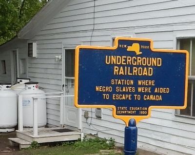
Underground Railroad
Erected 1950 by New York State Education Department.
Topics. This historical marker is listed in these topic lists: Abolition & Underground RR • African Americans.
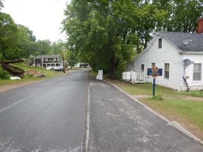
Location. 44° 30.357′ N, 73° 28.884′ W. Marker is in Keeseville, New York, in Clinton County. Marker is on Ausable Street, 0.1 miles north of Main Street (New York State Route 22), on the right when traveling north. Touch for map. Marker is in this post office area: Keeseville NY 12944, United States of America. Touch for directions.
Other nearby markers. At least 8 other markers are within 2 miles of this marker, measured as the crow flies. Keeseville, New York War Memorial (about 400 feet away, measured in a direct line); Mineral Spring (about 700 feet away); Train Depot (approx. ¼ mile away); Evergreen Cemetery (approx. 0.3 miles away); Thomas F. Conway (approx. 0.4 miles away); Rainbow Falls Hydroelectric Plant (approx. 1.6 miles away); The Boats And The Boatmen (approx. 1.6 miles away); What Is This Boat? (approx. 1.6 miles away). Touch for a list and map of all markers in Keeseville.
Also see . . . Keeseville Historic District - National Archives. National Register of Historic Places documentation. (Submitted on December 26, 2023, by Anton Schwarzmueller of Wilson, New York.)
Credits. This page was last revised on December 26, 2023. It was originally submitted on June 9, 2015, by Kevin Craft of Bedford, Quebec. This page has been viewed 587 times since then and 35 times this year. Photos: 1, 2. submitted on June 9, 2015, by Kevin Craft of Bedford, Quebec. • Bill Pfingsten was the editor who published this page.

