Near East Bernstadt in Laurel County, Kentucky — The American South (East South Central)
Battle of Camp Wildcat
(Marker #1)
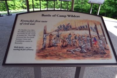
Battle of Camp Wildcat
Kentucky’s first taste of civil war
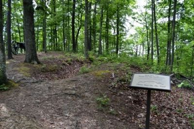
On October 21st 1861, the stillness of this forest was broken by the sound of musket fire. These hills witnessed the first battle between Union and Confederate armies in Kentucky.
Walk lightly – you are touching the face of history.
(Marker #2)
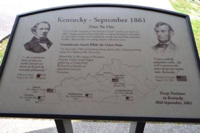
Kentucky - September 1861
Trust No One
The Civil War erupted at Fort Sumpter South Carolina on April 12, 1861. Despite promises from both sides to respect Kentucky’s neutrality, by September Union and Confederate troops had marched across her borders. Rumors flew of coming attacks and secret plots.
Confederates Attack While the Union Plans
On September 19th, Confederate forces destroyed a Union recruiting camp near Barbourville, Kentucky.
Meanwhile, at the urging of President Lincoln, Union troops began gathering at Camp Dick Robinson to launch an expedition into east Tennessee.
“... the Confederate States of America neither intends nor desires to disturb the neutrality of Kentucky.”
Jefferson Davis, August 28, 1861
“I most cordially sympathize with ... the wish to preserve the peace of my own native state, Kentucky ...”
Abraham Lincoln, August 24, 1861
(Marker #3)
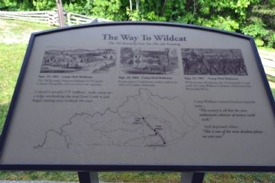
The Way To Wildcat
The 7th Kentucky Gets On-The-Job Training
Sept. 22, 1861 - Camp Dick Robinson
The 7th Kentucky Volunteer Infantry (USA) under Colonel Theophilus Garrard arrives for training.
Sept. 23, 1861 - Camp Dick Robinson
Scouts report Confederate cavalry within six miles of London, Kentucky.
Sept. 24, 1861 - Camp Dick Robinson
With one day of training, the 7th Kentucky is sent south to Camp Wildcat to protect a ford across the Rockcastle River.
Colonel Garrard’s 975 “soldiers” made camp on a ridge overlooking the road from London and began cutting trees to block the road.
Camp Wildcat’s remote location inspired some ... “The scenery is all that the most enthusiastic admirer of nature could wish.”
And depressed others ... “This is one of the most desolate places we ever saw.”
(Marker #4)
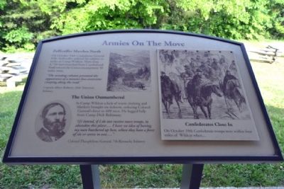
Armies On The Move
Zollicoffer Marches North
On October 16th Confederate General Felix Zollicoffer ordered his soldiers to strike at Camp Wildcat. More than 4,750 men marched from Cumberland Ford toward the Union encampment 50 miles away.
“The winding column presented the appearance of a monster boa constrictor creeping along the road.”
Captain Albert Roberts, 20th Tennessee Infantry
The Union Outnumbered
At Camp Wildcat a lack of warm clothing and blankets brought on sickness, reducing Colonel Garrard’s force to 600 men. He begged help from Camp Dick Robinson.
“(I) intend, if I do not receive more troops, to abandon this place.... I have no idea of having my men butchered up here, where they have a force of six or seven to one....”
Colonel Theophilous Garrard, 7th Kentucky Infantry
Confederates Close In
On October 19th Confederate troops were within four miles of Wildcat when ...
(Marker #5)
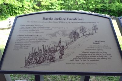
Battle Before Breakfast
The Confederates advanced on Camp Wildcat in the pre-dawn darkness of October 21.
Union Meals Were Interrupted
“About 7:00 a.m. ... while I was eating breakfast ... Gen. Schoepf rode up and told Col. Coburn to get his men in line immediately, that the enemy were right on us.”
Stephen Keyes Fletcher, 33rd Indiana Infantry
Enemies Met at Hoosier Knob
Colonel John Coburn and 350 men of the 33rd Indiana were rushed to an undefended hill which later became known as Hoosier Knob. Confederate soldiers were already climbing the other side. Scattered firing began and last for about an hour.
First Union Casualty
The Union forces suffered their first casualty in the opening moments of the fighting.
“About ten minues after the firing commenced, one of our men in Co. D, by the name of McFerrin, was shot in the left chest.... He walked up the hill to where we were standing and said, ‘Capt. I’m shot. I’m a dead man’.”
Stephen Keyes Fletcher, 33rd Indiana Infantry
(Marker #6)
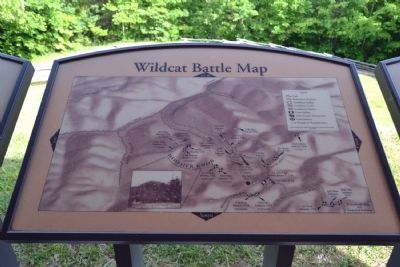
Wildcat Battle Map
(Marker #7)
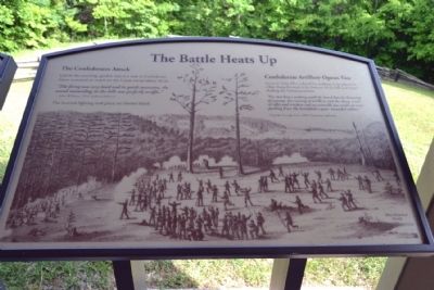
The Battle Heats Up
The Confederates Attack
Late in the morning, gunfire rose to a roar as Confederate forces mounted an attack on the Union troops above them.
“The firing was very hard an in quick succession, the sound resounding in the hills was perfectly teriffic.”
John Wilkens, 33rd Indiana Infantry
The heaviest fighting took place on Hoosier Knob.
Confederate Artillery Opens Up
General Zollicoffer ordered his artillery to be placed in a line along the road at the bottom of the hill and began shelling the Union positions.
“For two hours nothing could be heard but the booming of cannon, the roaring of artillery and the sharp crack of rifles and muskets and occasionally you could see men packing from the battlefield a poor wounded soldier.”
Captain George Faw, 20th Tennessee Infantry
(Marker #8)
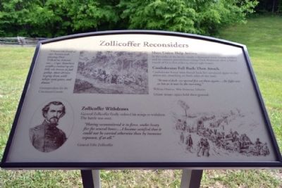
Zollicoffer Reconsiders
“I heard the band of our Seventeenth playing Hail Columbia behind me.... Capt. Standart’s artillery rushed up the hill, the horses at full gallop, their drivers urging them with whips and spurs, and shouts.”
Correspondent for the Cincinnati Gazette
More Union Help Arrives
In the midst of the battle, nearly a thousand more Union soldiers and six cannon arrived from Camp Dick Robinson after a forced march of forty-five miles in thirty-eight hours.
Confederates Fall Back - Then Attack
Confederate forces were forced back but advanced again in the afternoon, attacking both sides of the road.
“At two o’clock we opened fire on them again... the fight was as hot as it was in the morning.”
William Demoss, 20th Tennessee Infantry
Union troops again held their ground.
Zollicoffer Withdraws
General Zollicoffer finally ordered his troops to withdraw. The battle was over.
“Having reconnoitered it in force, under heavy fire for several hours.... I became satisfied that it could not be carrierd otherwise than by immense exposure, if at all.”
General Felix Zollicoffer
(Marker #9)
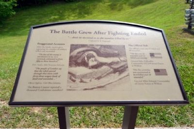
The Battle Grew After Fighting Ended
“... don’t be deceived as to the number killed by us;”
Colonel T.T. Garrard
Exaggerated Accounts
After the battle, stories grew regarding the number of soldiers killed and wounded.
“The loss of the enemy is not known to us, it is variously estimated at from fifty to three hundred.”
D.C. Scales, 20th Tennessee Infantry
“The people of London say that the rebels passed through that town with forty-three wagon loads of dead and wounded...”
Oliver Oglivie, 14th Ohio Infantry
The Boston Courier reported a thousand Confederate casualties!
The Official Toll
The official count was 15 killed and 60 wounded.
“Our loss was 42 wounded and 11 killed and missing.”
General Felix Zollicoffer, Commander of Confederate Forces at Wildcat
“Our loss yesterday was ascertained to be 4 killed and 18 wounded.”
General Albin Schoepf, Commander of Union Forces at Wildcat.
(Marker #10)
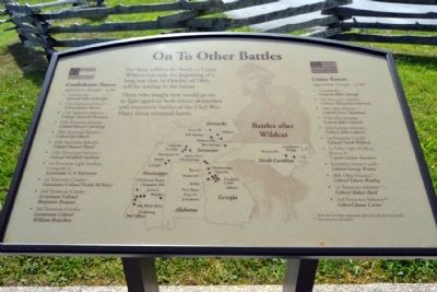
On To Other Battles
For these soldiers the Battle at Camp Wildcat was only the beginning of a long war that, in October of 1861, still lay waiting in the future.
Those who fought here would go on to fight again in both minor skirmishes and important battles of the Civil War. Many never returned home.
Confederate Forces
Approximate Strength -- 4,700
- Commander - General Felix Zollicoffer
- 11th Tennessee Infantry - Colonel James Raines
- 17th Tennessee Infantry - Colonel Tazewell Newman
- 19th Tennessee Infantry - Colonel David Cummings
- 20th Tennessee Infantry - Colonel Joel Battle
- 29th Tennessee Infantry - Colonel Samuel Powel
- 15th Mississippi Infantry - Colonel Winfield Statham
- 1st Tennessee Light Artillery, Company A - Lieutenant E.F. Falconnet
- 1st Tennessee Cavalry - Lieutenant Colonel Frank McNairy
- 2nd Tennessee Cavalry - Lieutenant Colonel Benjamin Branner
- 3rd Tennessee Cavalry - Lieutenant Colonel William Brazelton
Approximate Strength -- 3,700*
- Commander - General Albin Schoepf
- 7th Kentucky Infantry - Colonel Theophilus Garrard
- 14th Ohio Infantry - Colonel James Steedman
- 17th Ohio Infantry - Colonel John Connell
- 33rd Indiana Infantry - Colonel John Coburn
- 1st Kentucky Cavalry - Colonel Frank Wolford
- 1st Ohio Light Artillery, Battery B - Captain James Standart
- Kentucky Home Guard - Colonel George Brown
- 38th Ohio Infantry** - Colonel Edwin Bradley
- 1st Tennessee Infantry** - Colonel Robert Byrd
- 2nd Tennessee Infantry** - Colonel James Carter
** Arrived after the battle
Topics and series. This historical marker is listed in this topic list: War, US Civil. In addition, it is included in the Former U.S. Presidents: #16 Abraham Lincoln series list. A significant historical month for this entry is April 1884.
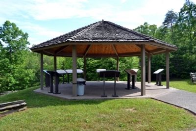
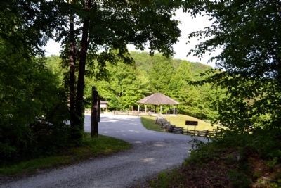
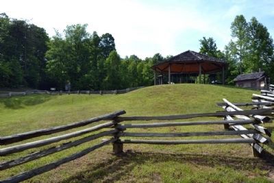
Location. 37° 15.88′ N, 84° 12.007′ W. Marker is near East Bernstadt, Kentucky, in Laurel County. Marker can be reached from Old Wilderness Road, 0.1 miles south of Camp Wildcat Road (Sheltowee Trace), on the right when traveling north. Marker is located at the Camp Wildcat Battlefield in the visitor pavilion next to the parking lot; directions to the battlefield are clearly marked from both Interstate 75 (Exit 49) and US Route 25. Touch for map. Marker is in this post office area: East Bernstadt KY 40729, United States of America. Touch for directions.
Other nearby markers. At least 8 other markers are within 3 miles of this marker, measured as the crow flies. A different marker also named Battle of Camp Wildcat (a few steps from this marker); Nerve Center for the Union Army (within shouting distance of this marker); The Battle of Wildcat (about 500 feet away, measured in a direct line); Camp Wildcat (about 500 feet away); Camp Wildcat and the Wilderness Road (approx. 0.3 miles away); Skaggs Trace (approx. 1.9 miles away); a different marker also named Camp Wildcat (approx. 2.2 miles away); Congressional Medal of Honor (approx. 2.4 miles away). Touch for a list and map of all markers in East Bernstadt.
Also see . . .
1. Camp Wildcat Preservation Foundation. Official website of the organization preserving the battlefield and making visitor improvements to the site. (Submitted on June 11, 2015.)
2. Battle of Camp Wildcat - Wikipedia entry. (Submitted on June 11, 2015.)
Credits. This page was last revised on June 16, 2016. It was originally submitted on June 11, 2015, by Duane Hall of Abilene, Texas. This page has been viewed 1,033 times since then and 68 times this year. Photos: 1, 2, 3, 4, 5, 6, 7, 8, 9, 10, 11, 12, 13, 14, 15. submitted on June 11, 2015, by Duane Hall of Abilene, Texas.
Editor’s want-list for this marker. The breaking out of these markers as separate marker pages. • Can you help?
