Smithville in DeKalb County, Tennessee — The American South (East South Central)
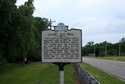
Evins' Old Mill
Erected by Tennesse Historical Commission. (Marker Number 2D 16.)
Topics and series. This historical marker is listed in this topic list: Industry & Commerce. In addition, it is included in the Tennessee Historical Commission series list. A significant historical year for this entry is 1837.
Location. 35° 57.448′ N, 85° 47.249′ W. Marker is in Smithville, Tennessee, in DeKalb County. Marker is at the intersection of Tennessee Route 26 and Evins Mill Road, on the right when traveling east on State Route 26. Touch for map. Marker is in this post office area: Smithville TN 37166, United States of America. Touch for directions.
Other nearby markers. At least 8 other markers are within 9 miles of this marker, measured as the crow flies. Darrin Vincent (approx. 1.4 miles away); DeKalb County in the Civil War (approx. 1.4 miles away); Dekalb County (approx. 1.4 miles away); Veterans Memorial DeKalb County Tennessee (approx. 1˝ miles away); DeKalb County Confederate Monument (approx. 1˝ miles away); Beckwith Inn (approx. 4.2 miles away); WW II Tennessee Maneuvers (approx. 8.4 miles away); Battle of Snow Hill (approx. 8˝ miles away). Touch for a list and map of all markers in Smithville.
Credits. This page was last revised on June 16, 2016. It was originally submitted on June 12, 2015, by Tom Bosse of Jefferson City, Tennessee. This page has been viewed 473 times since then and 17 times this year. Photos: 1, 2. submitted on June 12, 2015, by Tom Bosse of Jefferson City, Tennessee. • Bill Pfingsten was the editor who published this page.

