Near East Bernstadt in Laurel County, Kentucky — The American South (East South Central)
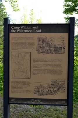
Camp Wildcat and the Wilderness Road
As wild as the new land was, however, the explorers did not have to find their way completely unaided. They found trails made by native people, as well as traces beaten down by herds of bison and other large animals. When Dr. Thomas Walker’s party entered what is now Kentucky through a pass, or a “gap,” in the Cumberland Mountain range, they followed an existing trail known as the War Road or Warriors’ Path. Later explorers and colonists also used this trail to pass through the Cumberland Gap.
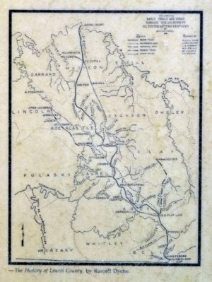
In 1775, Daniel Boone blazed a trail into Kentucky, using parts of the Warrior’s Path and other trails along his route. “Boone’s Trace” passes about three miles east of here. In the years that followed, thousands of settlers traveled Boone’s Trace, tripling the population of Kentucky by the time it became the 15th state in 1792.
In 1795, the new Kentucky legislature passed an act to open a wagon road from Crab Orchard, Kentucky, to Virginia through the Cumberland Gap. The new road followed portions of Boone’s Trace, but took a different route through this area, then known as the Rockcastle Hills. We now call this route “The Wilderness Road.”
The Wilderness Road was the most direct route for commerce traveling both into and out of Kentucky during the early 1800s. Other routes to the West were opened in the later part of the century, but the road played an important part in the Civil War. Confederate strategists saw it as a way to gain access into the populated Bluegrass region, and ultimately, the territory north of the Ohio River. For the Union, it was a route to the South and the Confederate’s supply line.
In the late summer of 1861, Union forces set up a camp at the junction of the Wilderness Road and the road leading to Richmond and Lexington. They named their camp “Wildcat.” When Confederate troops attacked the hilltop camp on October 21, 1861, they found it impossible to rout the Union soldiers from the Rockcastle Hills. Confederate General Zollicoffer later described Camp Wildcat as “a natural fortification, almost inaccessible.”
The Wilderness Road and Camp Wildcat continued to play a role throughout the war. The camp was used by both Confederate and Union forces, as control of this portion of the road shifted between the two armies.
Erected by Daniel Boone National Forest and Laurel County Historical
Society.
Topics. This historical marker is listed in these topic lists: Roads & Vehicles • War, US Civil. A significant historical month for this entry is October 1861.
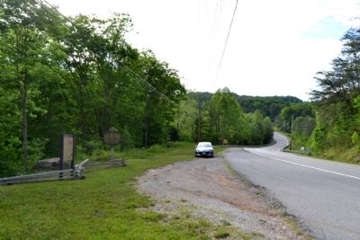
Location. 37° 13.674′ N, 84° 11.978′ W. Marker is near East Bernstadt, Kentucky, in Laurel County. Marker is on N. Laurel Road (U.S. 25) 0.1 miles south of Hazel Patch Road, on the right when traveling south. Touch for map. Marker is in this post office area: East Bernstadt KY 40729, United States of America. Touch for directions.
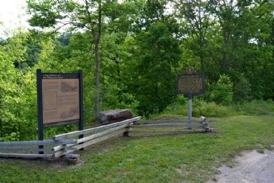
Other nearby markers. At least 8 other markers are within 3 miles of this marker, measured as the crow flies. Camp Wildcat / Union Civil War Camp (here, next to this marker); Camp Wildcat (approx. 0.4 miles away); Skaggs Trace (approx. 1˝ miles away); a different marker also named Camp Wildcat and the Wilderness Road (approx. 2.2 miles away); Nerve Center for the Union Army (approx. 2˝ miles away); Battle of Camp Wildcat (approx. 2˝ miles away); a different marker also named Battle of Camp Wildcat (approx. 2˝ miles away); The Battle of Wildcat (approx. 2.6 miles away). Touch for a list and map of all markers in East Bernstadt.
More about this marker. There is an identical marker located on Old Wilderness Road approx. three miles north of this marker.
Also see . . .
1. Battle of Camp Wildcat - Wikipedia entry. (Submitted on June 13, 2015.)
2. Wilderness Road - Wikipedia entry
. (Submitted on June 13, 2015.)
Credits. This page was last revised on June 16, 2016. It was originally submitted on June 13, 2015, by Duane Hall of Abilene, Texas. This page has been viewed 475 times since then and 26 times this year. Photos: 1, 2, 3, 4, 5. submitted on June 13, 2015, by Duane Hall of Abilene, Texas.
