Frankfort in Franklin County, Kentucky — The American South (East South Central)
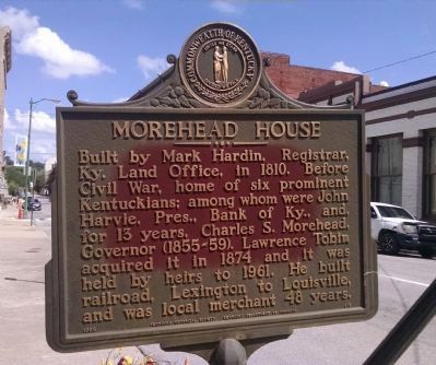
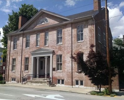
Morehead House
Erected 1965 by Kentucky Historical Society, Kentucky Department of Highways. (Marker Number 819.)
Topics and series. This historical marker is listed in this topic list: Notable Buildings. In addition, it is included in the Kentucky Historical Society series list. A significant historical year for this entry is 1810.
Location. 38° 11.945′ N, 84° 52.738′ W. Marker is in Frankfort, Kentucky, in Franklin County. Marker is on West Main Street, on the right when traveling west. Touch for map. Marker is at or near this postal address: 326 West Main Street, Frankfort KY 40601, United States of America. Touch for directions.
Other nearby markers. At least 8 other markers are within walking distance of this marker. John Goodman House (a few steps from this marker); Chapman Coleman Todd House (a few steps from this marker); Gov. Owsley House Saved (within shouting distance of this marker); Crittenden House / An Eminent Statesman (within shouting distance of this marker); Macklin House (within shouting distance of this marker); First Methodist Church (within shouting distance of this marker); The Church of the Ascension (within shouting distance of this marker); Emily Thomas Tubman House (about 300 feet away, measured in a direct line). Touch for a list and map of all markers in Frankfort.
Credits. This page was last revised on June 16, 2016. It was originally submitted on June 15, 2015, by Dave Knoch of Scott County, Kentucky. This page has been viewed 460 times since then and 37 times this year. Photos: 1, 2. submitted on June 15, 2015, by Dave Knoch of Scott County, Kentucky. • Bill Pfingsten was the editor who published this page.

