Saint Andrews, Manitoba — Canada’s Prairie Region (North America)
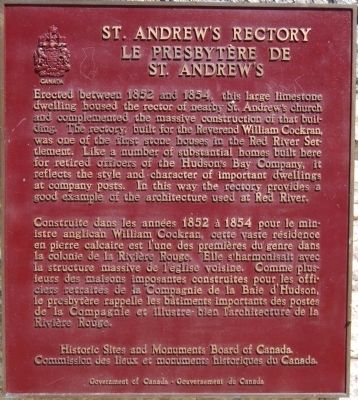
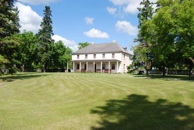
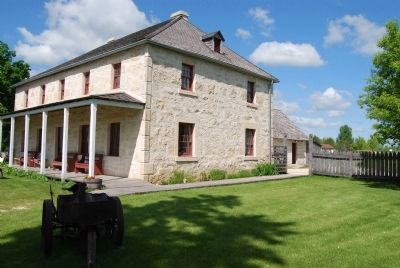
St. Andrew’s Rectory
Le Presbytère de St. Andrew’s. Construite dans les années 1852 à 1854 pour le ministre anglican William Cockran, cette vaste résidence en pierre calcaire est l’une des premières du genre dans la colonie de la Rivière Rouge. Elle s’harmonisait avec la structure massive de l’élise voisine. Comme plusiurs des maisons imposantes construites pour les officiers retraités de la Compagnie de la Baie d’Hudson, le presbytére rappelle les bâtiments importants de postes de la Compagnie et illustre bien l’architecture de la Rivière Rouge.
Erected 1984 by Historic Sites and Monuments Board of Canada.
Topics and series. This historical marker is listed in these topic lists: Churches & Religion • Notable Buildings • Settlements & Settlers. In addition, it is included in the Canada, Historic Sites and Monuments Board series list. A significant historical year for this entry is 1852.
Location. 50° 3.985′ N, 96° 58.663′ W. Marker is in Saint Andrews, Manitoba. Marker is at the intersection of River Road (Provincial Highway 238) and St. Andrew's Road (Provincial Highway 410), on the left when traveling north on River Road. Touch for map. Marker is at or near this postal address: 347 River Road, Saint Andrews MB R1A 2Y1, Canada. Touch for directions.
Other nearby markers. At least 8 other markers are within 23 kilometers of this marker, measured as the crow flies. St. Andrews Anglican Church (within shouting distance of this marker); Twin Oaks (approx. 1.4 kilometers away); St. Andrews Caméré Curtain Dam (approx. 3.1 kilometers away); Nicolaus Copernicus / Mikołaj Kopernik (approx. 21.7 kilometers away); Commemorating Manitoba Theatre Centre's 50th Anniversary (approx. 21.9 kilometers away); St. Boniface / Saint-Boniface (approx. 21.9 kilometers away); First Salvation Army Meeting West of the Great Lakes (approx. 21.9 kilometers away); The Royal Manitoba Theatre Centre (approx. 21.9 kilometers away). Touch for a list and map of all markers in Saint Andrews.
Credits. This page was last revised on January 23, 2022. It was originally submitted on June 20, 2008, by Dawn Bowen of Fredericksburg, Virginia. This page has been viewed 2,272 times since then and 7 times this year. Photos: 1, 2, 3, 4. submitted on June 20, 2008, by Dawn Bowen of Fredericksburg, Virginia. • J. J. Prats was the editor who published this page.


