Troy Hill in Pittsburgh in Allegheny County, Pennsylvania — The American Northeast (Mid-Atlantic)
Mala Jaska
The Story of a Croatian Community
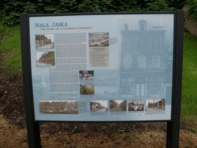
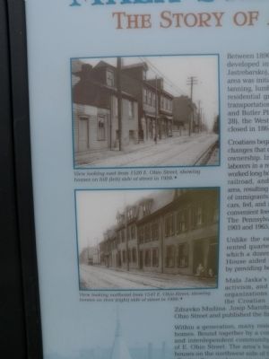
Croatians began settling in the North Side in 1882 in response to governmental changes that deprived them of political power, agricultural markets and land ownership. In Croatia, most of the immigrants had worked as agricultural laborers in a region knonwns for its grape production. In America, the immigrants worked long hours at industrial jobs. By 1900, food production, animal by-products, railroad, and steel industries became the dominant employers in the area, resulting in a demand for unskilled laborers that attracted a large number of immigrants. An 1873 federal law required animals to be removed from box cars, fed, and rested after 28 hours of confinement, and Herr's Island was a convenient feed and rest-stop between Chicago and eastern markets. The Pennsylvania Railroad operated stock yards at Herr's Island between 1903 and 1965, providing a range of livestock-related jobs to the neighborhood.
Unlike the earlier German settlers, the immigrants typically lived in rented quarters, either in subdivided homes or in boarding houses in which a dozen or more single men would live. The nearby Sarah Heinz House aided the Croatian community in its transaction to American life by providing boys and girls with educational and recreational facilities.
Mala Jaska's Croatian population was distinguished by its political activism, and such sentiments were expressed through a number of organizations and newspapers. The Croatian newspaper, Danica, and the Croatian Fraternal Union of America were begun in 1894 by Zdravko Mužina, Josip Marohnić operated America's first Croatian bookstore at 1420 E. Ohio Street and published the first Croatian-English dictionary for fellow immigrants.
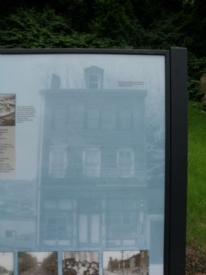
Withing a generation, many residents of Mala Jaska owned their own homes. Bound together by a common faith and language, a tight knit and independent community developed along this narrow stretch of E. Ohio Street. The area's topography gave it a unique character: houses on the northwest side of the street were banked into the hillside, allowing the use of masonry vaults for cold storage; on the southeast side of the street, houses only two-rooms deep were squeezed between the street and railroad, allowing trains to pass within a few feet of the rear windows. The steep hillsides were terraced for growing fruits and vegetables, which were shared among neighbors. Residents took great pride in their community and beautified their yards with terraced flower gardens.
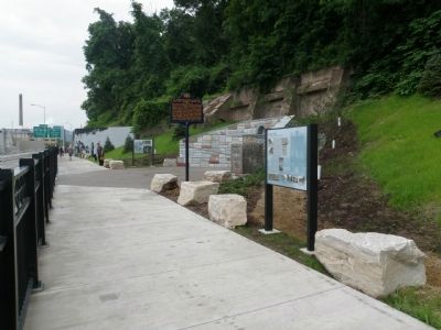
The neighborhood's greatest asset, its proximity to numerous modes of transportation, ultimately became the source of its demise. In 1921, E. Ohio Street was expanded from two to four lanes, resulting in the removal of all buildings on the southeast side of the street and the demolition or alteration of numerous building on the northwest side of the street. Further decline occurred in 2014 with the completion of the State Route 28 safety and improvement project, which razed the neighborhood's remaining buildings on the northwest side of the street.
Topics. This historical marker is listed in these topic lists: Fraternal or Sororal Organizations • Labor Unions • Settlements & Settlers. A significant historical year for this entry is 1890.
Location. 40° 27.503′ N, 79° 59.189′ W. Marker is in Pittsburgh, Pennsylvania, in Allegheny County
. It is in Troy Hill. Marker can be reached from Walkway to St. Nicholas Church Historic Site, 0.7 miles south of 31st Street Bridge. Located at the St. Nicholas Church Historic Site. Touch for map. Marker is in this post office area: Pittsburgh PA 15212, United States of America. Touch for directions.
Other nearby markers. At least 8 other markers are within walking distance of this marker. St. Nicholas Roman Catholic Croatian Church, North Side (here, next to this marker); Our Lady of Lourdes Grotto (here, next to this marker); St. Nicholas Church (here, next to this marker); St. Nicholas Church and Mala Jaska (about 500 feet away, measured in a direct line); Herr's Island (approx. 0.2 miles away); The Lagering Caves (approx. Ľ mile away); E & O Brewery (approx. 0.3 miles away); The Biergarten (approx. 0.3 miles away). Touch for a list and map of all markers in Pittsburgh.
Also see . . . North Side's 'Mala Jaska' deteriorates as Route 28 grows. May 20, 2009 article in the Pittsburgh Post-Gazette (Submitted on June 21, 2015, by Mike Wintermantel of Pittsburgh, Pennsylvania.)
Photographed By Mike Wintermantel, June 20, 2015
4. Mala Jaska Marker
(top photo)
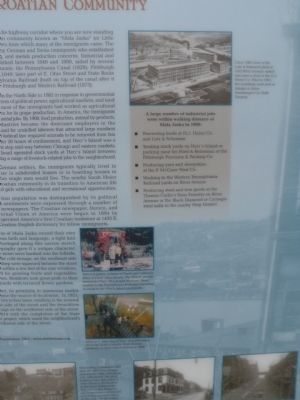
Circa 1905 view of the Lutz & Schramm plant at 1412 River Avenue, which was once a rival of the H.J. Heinz Co. Prior to 1901, the buildings were part of Adolph & Julius Groetzinger's La Belle Tannery.
A large number of industrial jobs were within walking distance of Mala Jaska in 1900:
• Processing foods at H.J. Heinz Co. and Lutz & Schramm
• Tending stock yards on Herr's Island or packing meat for Fried & Reineman or the Pittsburgh Provision & Packing Co.
• Producing yarn and sheepskins at the P. McGraw Wool Co.
• Working in the Western Pennsylvania Railroad yards on River Avenue
• Producing steel and iron goods at the Thomas Carlin's Sons Foundry on River Avenue or the Black Diamond or Carnegie steel mills in the nearby Strip District
(center photo)
Terraced garden at home of Frank and Catherine Ribar (1410 E. Ohio Street). The Ribars' parents immigrated from villages near Karlovac. Frank worked for the Pennsylvania Railroad unloading animals at the Herr's Island stockyards.
(bottom photo)
View of E. Ohio Street from Troy Hill steps, showing North Catholic High School students on their way to school in 1966.
Photographed By Mike Wintermantel, June 20, 2015
5. Mala Jaska Marker photo inset
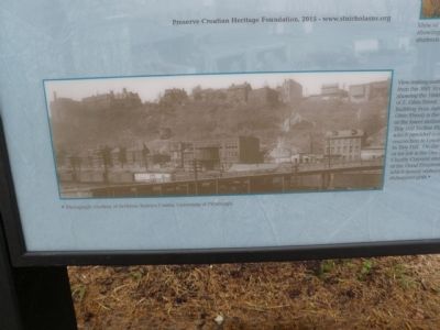
View looking northwest in 1920 from the 30th Street Bridge, showing the 1600-1700 blocks of E. Ohio Street. The third building from right (1726 E. Ohio Street) is the location of the lower station of the Troy Hill Incline Plane Co., which provided a convenient connection to Lowrie Street in Troy Hill. On the hilltop at far left is the Our Lady of Charity Convent and Sisters of the Good Shepherd Home, which served orphaned and delinquent girls.
Photographed By Mike Wintermantel, June 20, 2015
6. Mala Jaska Marker photo inset
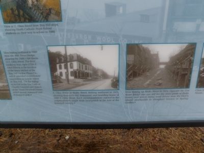
(left photo)
E. Ohio Street at Rialto Street, looking northeast in 1913, showing Kroemer's bar, restaurant, and boarding house at 1900 E. Ohio Street. Such accommodations catered to the neighborhood's single male immigrants at the turn of the twentieth century.
(right photo)
View looking up Rialto Street in 1914. Opposite the 31st Street Bridge one can still see the steep grade of Rialto Street, over which swine were driven from the Herr's Island stockyards to slaughter houses in Spring Garden.
Photographed By Mike Wintermantel, June 20, 2015
7. Mala Jaska Marker photo inset
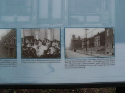
(left photo)
Circa 1920s view of girls sewing at the Sarah Heinz House. Photo courtesy of Sarah Heinz House
(right photo)
View looking west from 1418 E. Ohio Street toward Duquesne School (later St. Nicholas School) in 1920. The school opened in 1884 to serve Allegheny City's growing 8th Ward, which had increased from 870 to 2,709 residents between 1850 to 1880. It operated as a parochial school from 1931 to 1969.
Credits. This page was last revised on February 2, 2023. It was originally submitted on June 20, 2015, by Mike Wintermantel of Pittsburgh, Pennsylvania. This page has been viewed 831 times since then and 115 times this year. Photos: 1, 2, 3, 4, 5, 6, 7, 8. submitted on June 21, 2015, by Mike Wintermantel of Pittsburgh, Pennsylvania.
