Near Round Top in Fayette County, Texas — The American South (West South Central)
Nassau Plantation
Nassau Plantation
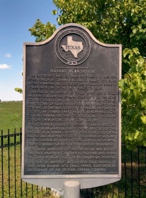
An extensive tract of land purchased in 1843 for colonization by German emigrants. Named for Duke Adolf of Nassau, protector of the emigration society, it was once one of the show places of Texas.
Although the 4,428 acres could have been a good half-way station for German colonists on the long journey to western lands, this use was rejected by Prince Carl of Solms-Braunfels, the commissioner general of the "Adelsverein", or German Emigration Society. He feared that the site, which was close to non-German settlements, would cause his people to lose their distinctive national culture.
Though never colonized, Nassau became a welcome place for relaxation during trying periods of the emigration movement. Here the prince enjoyed horse racing and held feasts costing thousands of dollars. His successor as commissioner, John O. Meusebach, came to Nassau for less extravagant entertainment.
The main dwelling on the plantation was built of oak, two stories high. Even in frontier days it had two glass windows. Cotton was grown on the lands.
In 1848 the bankrupt Adelsverein sold Nassau. It was later divided into small farms, cultivated by descendants of the original German pioneers.
Erected 1968 by State Historical Survey Committee. (Marker Number 3550.)
Topics. This historical marker is listed in this topic list: Settlements & Settlers. A significant historical year for this entry is 1843.
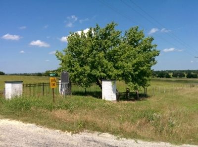
Location. 30° 4.204′ N, 96° 39.13′ W. Marker is near Round Top, Texas, in Fayette County. Marker is at the intersection of Farm to Market Road 1457 and Wolff Road (County Road 279), on the right when traveling east on Road 1457. Located on southwest corner of the intersection. Touch for map. Marker is in this post office area: Round Top TX 78954, United States of America. Touch for directions.
Other nearby markers. At least 8 other markers are within 3 miles of this marker, measured as the crow flies. Winedale Stagecoach Inn (approx. 1.3 miles away); Round Top Academy (approx. 1˝ miles away); Connersville Primitive Baptist Church African American Cemetery (approx. 1˝ miles away); Samuel Knight Lewis (approx. 1˝ miles away); The Log Cabin (approx. 2.4 miles away); Pumper Wagon (approx. 2˝ miles away); The Connersville Museum (approx. 2˝ miles away); Noak Farmhouse (approx. 2˝ miles away). Touch for a list and map of all markers in Round Top.
Also see . . . Nassau Farm article in Handbook of Texas. (Submitted on June 22, 2015, by Gregory Walker of La Grange, Texas.)
Credits. This page was last revised on June 16, 2016. It was originally submitted on June 22, 2015, by Gregory Walker of La Grange, Texas. This page has been viewed 759 times since then and 41 times this year. Photos: 1, 2. submitted on June 22, 2015, by Gregory Walker of La Grange, Texas. • Bernard Fisher was the editor who published this page.

