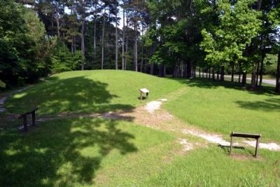
Near New Houlka in Chickasaw County, Mississippi — The American South (East South Central)
Archaeology Determines the Age of Owl Creek Mounds
Inscription.
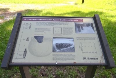
Owl Creek Mounds were built between 800 and 900 years ago and were used for only about 100 years. This was determined by the dating of charcoal samples collected at the site and by studying the artifacts and type of building remains found in the mounds.
Artifacts provide an easy method for establishing the time period of a site. Pottery, even in broken pieces, works especially well. For example, people of the Mississippian culture made pots with crushed mussel shell added to the clay as temper. Pottery tempered with crushed mussel shell was found in all five mounds.
Using wall trenches in the construction of buildings is also typical of the Mississippian cultures. The builders dug narrow trenches where each wall was to be placed. They then set the posts, sometimes in postholes dug in the bottom of the trenches. The wall trenches were filled with dirt to hold the posts in place. Archaeological excavations found wall trenches in Mounds I, II, and IV. This method of construction also confirms that the mounds were built during the Mississippian period.
Archaeologists discovered the age of the mounds by using the radiocarbon method to date charcoal samples. This tells how much time has passed since the charred remains were living organisms such as trees or corn plants. All living things absorb carbon-14, along with stable carbon-12, from the atmosphere. When they die, this absorption stops while the carbon-14 in their tissues continues to decay radioactively. Since we know how fast carbon-14 decays, measuring the amount left can provide a date for each charcoal sample.
Small amounts of charcoal were carefully collected from a wall trench and postholes in Mounds I, II, and V. The radiocarbon lab counted the amount of radioactive carbon-14 left in each sample. Five different radiocarbon dates were determined. The dates spanned from the period A.D. 1133 to A.D. 1219.
Erected by United States Forest Service and Mississippi State University.
Topics. This historical marker is listed in these topic lists: Native Americans • Science & Medicine.
Location. 34° 3.385′ N, 88° 55.458′ W. Marker is near New Houlka, Mississippi, in Chickasaw County. Marker can be reached from County Road 413, 2˝ miles west of Natchez Trace Parkway, on the right when traveling west. Marker is located at the Owl Creek Archaeological Site in Tombigbee National Forest. Touch for map. Marker is in this post office area: Houlka MS 38850, United States of America. Touch for directions.
Other nearby markers. At least 8 other markers are within 4 miles of this marker, measured as the crow flies. Archaeology at Owl Creek Mounds (a few steps from this marker); a different marker also named Archaeology at Owl Creek Mounds (a few steps from this marker); De Soto's Expedition (within shouting distance of this marker); Owl Creek Mounds (within shouting distance of this marker); William Colbert's Last Homesite (about 400 feet away, measured in a direct line); Hernando de Soto (approx. 2.6 miles away); Monroe Mission Station (approx. 3.3 miles away); Chickasaw Agency (approx. 3.3 miles away). Touch for a list and map of all markers in New Houlka.
Credits. This page was last revised on June 16, 2016. It was originally submitted on June 25, 2015, by Duane Hall of Abilene, Texas. This page has been viewed 392 times since then and 23 times this year. Photos: 1, 2, 3. submitted on June 25, 2015, by Duane Hall of Abilene, Texas. 4. submitted on June 24, 2015, by Duane Hall of Abilene, Texas. 5. submitted on June 25, 2015, by Duane Hall of Abilene, Texas.
